You are here: Home > Network List > US - United States National Seismic Network Stations List
> Station WMOK Wichita Mountains, Oklahoma, USA > Earthquake Result Viewer
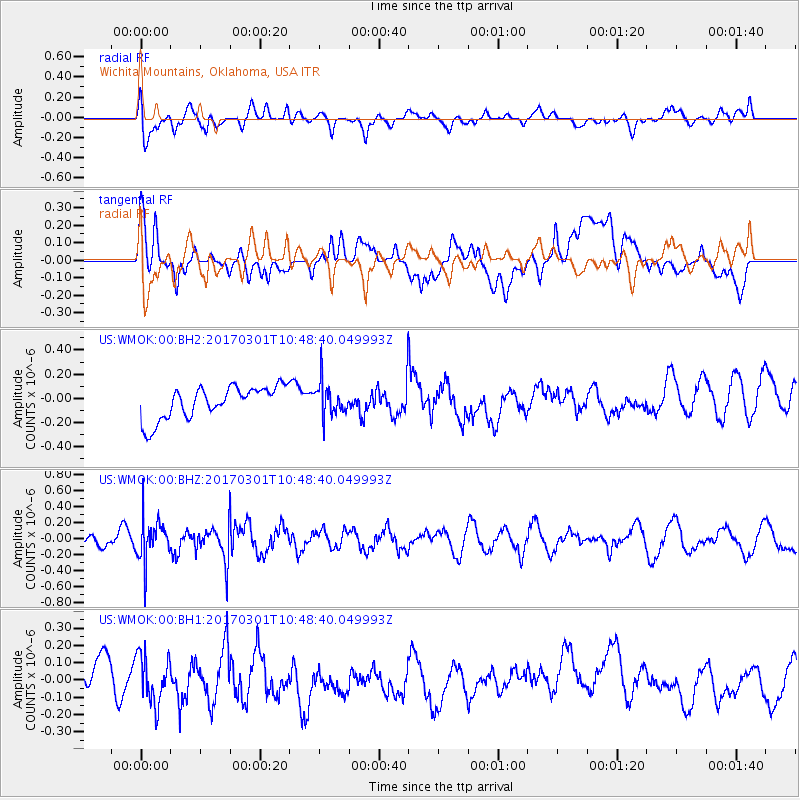
WMOK Wichita Mountains, Oklahoma, USA - Earthquake Result Viewer
*The percent match for this event was below the threshold and hence no stack was calculated.
| Earthquake location: |
Andreanof Islands, Aleutian Is. |
| Earthquake latitude/longitude: |
52.2/-173.4 |
| Earthquake time(UTC): |
2017/03/01 (060) 10:39:49 GMT |
| Earthquake Depth: |
58 km |
| Earthquake Magnitude: |
5.5 mb |
| Earthquake Catalog/Contributor: |
NEIC PDE/us |
|
| Network: |
US United States National Seismic Network |
| Station: |
WMOK Wichita Mountains, Oklahoma, USA |
| Lat/Lon: |
34.74 N/98.78 W |
| Elevation: |
486 m |
|
| Distance: |
54.4 deg |
| Az: |
77.442 deg |
| Baz: |
313.121 deg |
| Ray Param: |
$rayparam |
*The percent match for this event was below the threshold and hence was not used in the summary stack. |
|
| Radial Match: |
55.86471 % |
| Radial Bump: |
400 |
| Transverse Match: |
48.553123 % |
| Transverse Bump: |
400 |
| SOD ConfigId: |
1992691 |
| Insert Time: |
2017-03-15 10:44:54.875 +0000 |
| GWidth: |
2.5 |
| Max Bumps: |
400 |
| Tol: |
0.001 |
|
Signal To Noise
| Channel | StoN | STA | LTA |
| US:WMOK:00:BHZ:20170301T10:48:40.049993Z | 1.9863237 | 2.624813E-7 | 1.3214428E-7 |
| US:WMOK:00:BH1:20170301T10:48:40.049993Z | 1.1746162 | 1.4007914E-7 | 1.1925525E-7 |
| US:WMOK:00:BH2:20170301T10:48:40.049993Z | 1.0121753 | 1.3569047E-7 | 1.3405827E-7 |
| Arrivals |
| Ps | |
| PpPs | |
| PsPs/PpSs | |


