You are here: Home > Network List > IW - Intermountain West Stations List
> Station MOOW Moose Ponds, Wyoming, USA > Earthquake Result Viewer
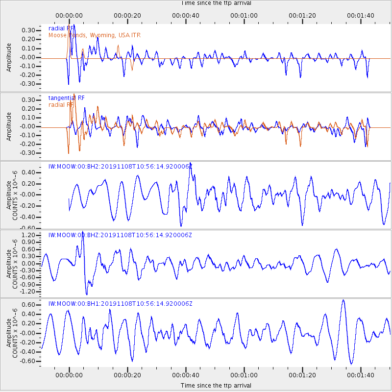
MOOW Moose Ponds, Wyoming, USA - Earthquake Result Viewer
*The percent match for this event was below the threshold and hence no stack was calculated.
| Earthquake location: |
Fiji Islands Region |
| Earthquake latitude/longitude: |
-22.0/-179.5 |
| Earthquake time(UTC): |
2019/11/08 (312) 10:44:44 GMT |
| Earthquake Depth: |
583 km |
| Earthquake Magnitude: |
6.5 Mww |
| Earthquake Catalog/Contributor: |
NEIC PDE/us |
|
| Network: |
IW Intermountain West |
| Station: |
MOOW Moose Ponds, Wyoming, USA |
| Lat/Lon: |
43.75 N/110.74 W |
| Elevation: |
2128 m |
|
| Distance: |
90.7 deg |
| Az: |
42.49 deg |
| Baz: |
239.904 deg |
| Ray Param: |
$rayparam |
*The percent match for this event was below the threshold and hence was not used in the summary stack. |
|
| Radial Match: |
75.89589 % |
| Radial Bump: |
400 |
| Transverse Match: |
50.81684 % |
| Transverse Bump: |
400 |
| SOD ConfigId: |
19951751 |
| Insert Time: |
2019-11-22 10:53:10.694 +0000 |
| GWidth: |
2.5 |
| Max Bumps: |
400 |
| Tol: |
0.001 |
|
Signal To Noise
| Channel | StoN | STA | LTA |
| IW:MOOW:00:BHZ:20191108T10:56:14.920006Z | 1.7248201 | 5.3384576E-7 | 3.0950807E-7 |
| IW:MOOW:00:BH1:20191108T10:56:14.920006Z | 1.496932 | 3.287446E-7 | 2.1961223E-7 |
| IW:MOOW:00:BH2:20191108T10:56:14.920006Z | 1.0749202 | 2.3591735E-7 | 2.194743E-7 |
| Arrivals |
| Ps | |
| PpPs | |
| PsPs/PpSs | |


