You are here: Home > Network List > TA - USArray Transportable Network (new EarthScope stations) Stations List
> Station G21K Allakaket, AK, USA > Earthquake Result Viewer
G21K Allakaket, AK, USA - Earthquake Result Viewer
*The percent match for this event was below the threshold and hence no stack was calculated.
| Earthquake location: |
Fiji Islands Region |
| Earthquake latitude/longitude: |
-22.0/-179.5 |
| Earthquake time(UTC): |
2019/11/08 (312) 10:44:44 GMT |
| Earthquake Depth: |
583 km |
| Earthquake Magnitude: |
6.5 Mww |
| Earthquake Catalog/Contributor: |
NEIC PDE/us |
|
| Network: |
TA USArray Transportable Network (new EarthScope stations) |
| Station: |
G21K Allakaket, AK, USA |
| Lat/Lon: |
66.52 N/153.51 W |
| Elevation: |
446 m |
|
| Distance: |
90.4 deg |
| Az: |
10.113 deg |
| Baz: |
203.999 deg |
| Ray Param: |
$rayparam |
*The percent match for this event was below the threshold and hence was not used in the summary stack. |
|
| Radial Match: |
41.968464 % |
| Radial Bump: |
400 |
| Transverse Match: |
45.28876 % |
| Transverse Bump: |
400 |
| SOD ConfigId: |
19951751 |
| Insert Time: |
2019-11-22 10:55:13.460 +0000 |
| GWidth: |
2.5 |
| Max Bumps: |
400 |
| Tol: |
0.001 |
|
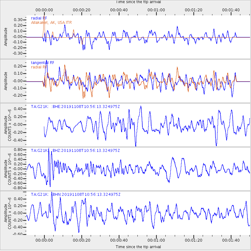
Signal To Noise
| Channel | StoN | STA | LTA |
| TA:G21K: :BHZ:20191108T10:56:13.324975Z | 3.4236274 | 4.5544195E-7 | 1.3302908E-7 |
| TA:G21K: :BHN:20191108T10:56:13.324975Z | 1.4881383 | 2.028113E-7 | 1.3628525E-7 |
| TA:G21K: :BHE:20191108T10:56:13.324975Z | 1.759522 | 2.1326524E-7 | 1.2120636E-7 |
| Arrivals |
| Ps | |
| PpPs | |
| PsPs/PpSs | |


