You are here: Home > Network List > TA - USArray Transportable Network (new EarthScope stations) Stations List
> Station H16K Elim, AK, USA > Earthquake Result Viewer
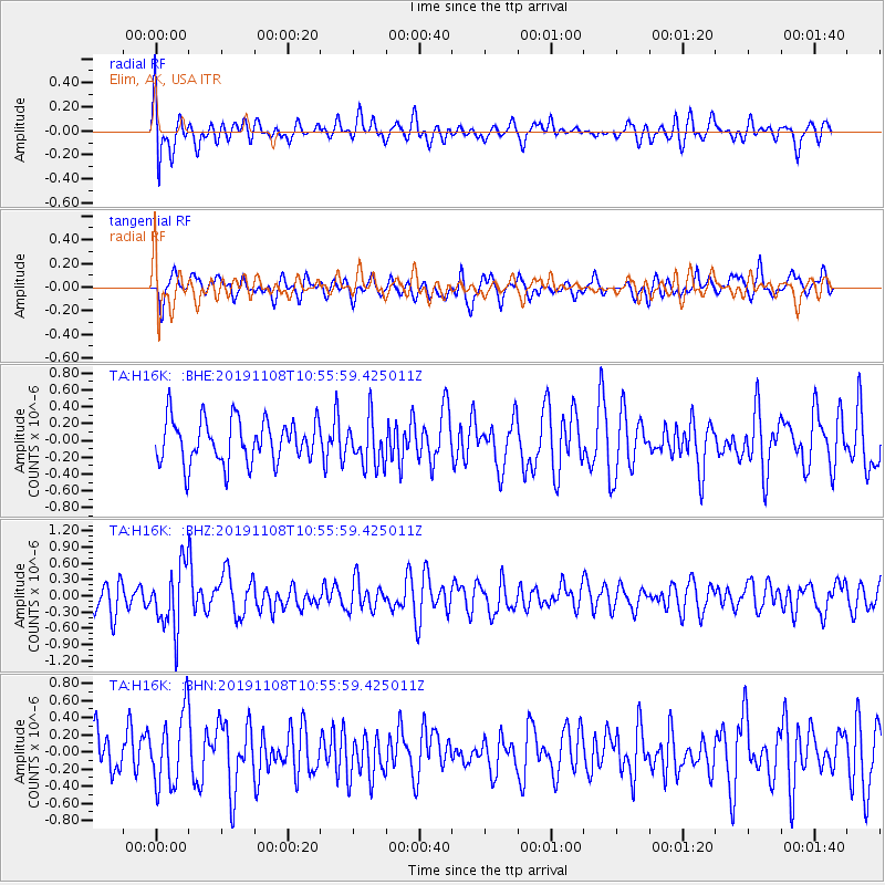
H16K Elim, AK, USA - Earthquake Result Viewer
*The percent match for this event was below the threshold and hence no stack was calculated.
| Earthquake location: |
Fiji Islands Region |
| Earthquake latitude/longitude: |
-22.0/-179.5 |
| Earthquake time(UTC): |
2019/11/08 (312) 10:44:44 GMT |
| Earthquake Depth: |
583 km |
| Earthquake Magnitude: |
6.5 Mww |
| Earthquake Catalog/Contributor: |
NEIC PDE/us |
|
| Network: |
TA USArray Transportable Network (new EarthScope stations) |
| Station: |
H16K Elim, AK, USA |
| Lat/Lon: |
64.64 N/162.24 W |
| Elevation: |
216 m |
|
| Distance: |
87.4 deg |
| Az: |
7.346 deg |
| Baz: |
195.997 deg |
| Ray Param: |
$rayparam |
*The percent match for this event was below the threshold and hence was not used in the summary stack. |
|
| Radial Match: |
60.584934 % |
| Radial Bump: |
400 |
| Transverse Match: |
50.97873 % |
| Transverse Bump: |
358 |
| SOD ConfigId: |
19951751 |
| Insert Time: |
2019-11-22 10:55:16.042 +0000 |
| GWidth: |
2.5 |
| Max Bumps: |
400 |
| Tol: |
0.001 |
|
Signal To Noise
| Channel | StoN | STA | LTA |
| TA:H16K: :BHZ:20191108T10:55:59.425011Z | 2.4191139 | 5.77157E-7 | 2.38582E-7 |
| TA:H16K: :BHN:20191108T10:55:59.425011Z | 1.7851092 | 4.2293541E-7 | 2.3692411E-7 |
| TA:H16K: :BHE:20191108T10:55:59.425011Z | 1.0718447 | 2.7630648E-7 | 2.5778593E-7 |
| Arrivals |
| Ps | |
| PpPs | |
| PsPs/PpSs | |


