You are here: Home > Network List > TA - USArray Transportable Network (new EarthScope stations) Stations List
> Station W17A Winslow, AZ, USA > Earthquake Result Viewer
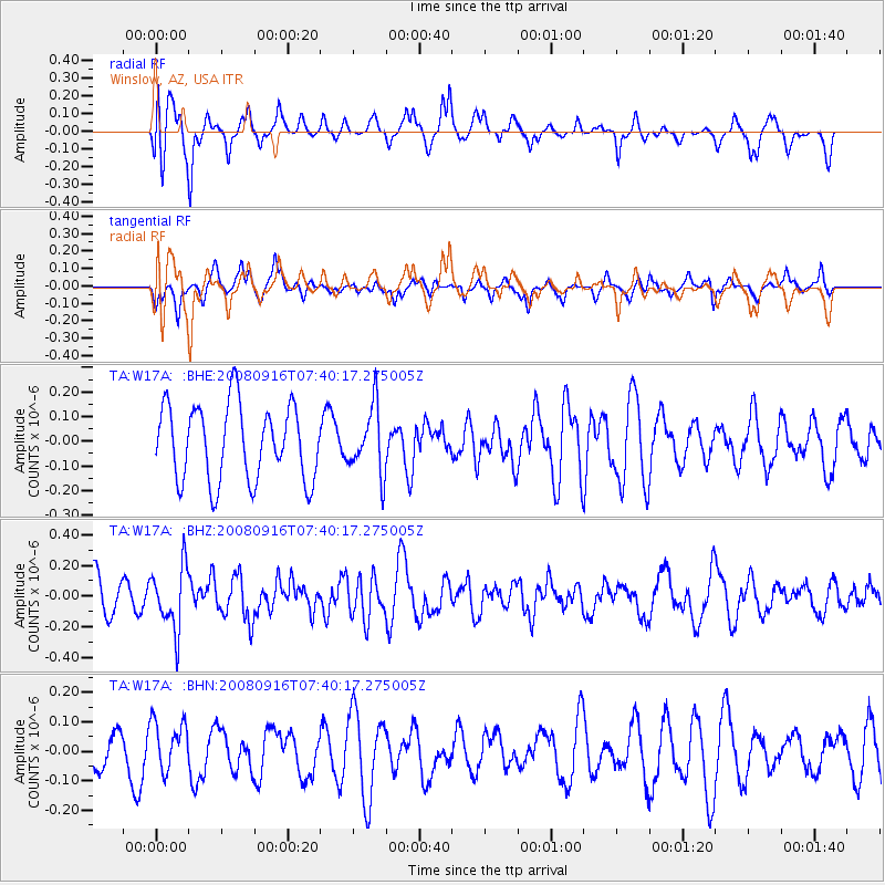
W17A Winslow, AZ, USA - Earthquake Result Viewer
*The percent match for this event was below the threshold and hence no stack was calculated.
| Earthquake location: |
Central Mid-Atlantic Ridge |
| Earthquake latitude/longitude: |
0.9/-29.0 |
| Earthquake time(UTC): |
2008/09/16 (260) 07:28:25 GMT |
| Earthquake Depth: |
10 km |
| Earthquake Magnitude: |
5.8 MW, 5.2 MS, 5.2 MB, 5.8 MW |
| Earthquake Catalog/Contributor: |
WHDF/NEIC |
|
| Network: |
TA USArray Transportable Network (new EarthScope stations) |
| Station: |
W17A Winslow, AZ, USA |
| Lat/Lon: |
35.08 N/110.71 W |
| Elevation: |
1461 m |
|
| Distance: |
82.7 deg |
| Az: |
305.09 deg |
| Baz: |
94.024 deg |
| Ray Param: |
$rayparam |
*The percent match for this event was below the threshold and hence was not used in the summary stack. |
|
| Radial Match: |
68.412155 % |
| Radial Bump: |
400 |
| Transverse Match: |
58.53783 % |
| Transverse Bump: |
379 |
| SOD ConfigId: |
2504 |
| Insert Time: |
2010-03-07 05:43:29.640 +0000 |
| GWidth: |
2.5 |
| Max Bumps: |
400 |
| Tol: |
0.001 |
|
Signal To Noise
| Channel | StoN | STA | LTA |
| TA:W17A: :BHZ:20080916T07:40:17.275005Z | 1.5983878 | 2.0424643E-7 | 1.2778277E-7 |
| TA:W17A: :BHN:20080916T07:40:17.275005Z | 1.3299992 | 8.566002E-8 | 6.440607E-8 |
| TA:W17A: :BHE:20080916T07:40:17.275005Z | 0.87614936 | 1.3408868E-7 | 1.5304317E-7 |
| Arrivals |
| Ps | |
| PpPs | |
| PsPs/PpSs | |


