
R15A Junction, UT, USA - Earthquake Result Viewer
| ||||||||||||||||||
| ||||||||||||||||||
| ||||||||||||||||||
|
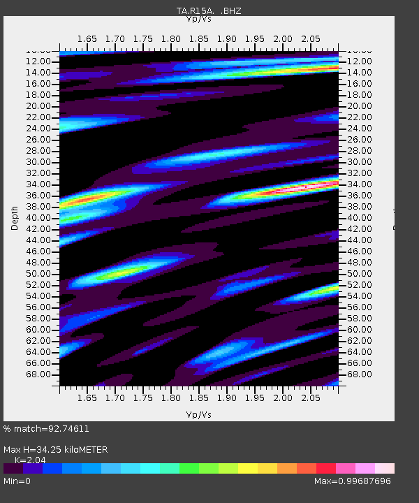
Signal To Noise
| Channel | StoN | STA | LTA |
| TA:R15A: :BHZ:20080719T02:50:54.423999Z | 3.6248662 | 3.881507E-7 | 1.0708001E-7 |
| TA:R15A: :BHN:20080719T02:50:54.423999Z | 0.79599524 | 8.183277E-8 | 1.0280561E-7 |
| TA:R15A: :BHE:20080719T02:50:54.423999Z | 1.153639 | 1.294193E-7 | 1.12183535E-7 |
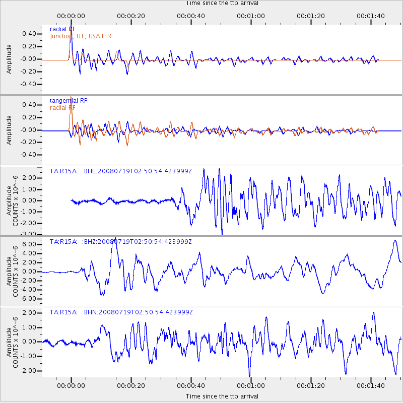
| Arrivals | |
| Ps | 5.8 SECOND |
| PpPs | 16 SECOND |
| PsPs/PpSs | 22 SECOND |

