You are here: Home > Network List > UW - Pacific Northwest Regional Seismic Network Stations List
> Station LEBA Lebam, WA, USA > Earthquake Result Viewer
LEBA Lebam, WA, USA - Earthquake Result Viewer
*The percent match for this event was below the threshold and hence no stack was calculated.
| Earthquake location: |
Fiji Islands Region |
| Earthquake latitude/longitude: |
-22.0/-179.5 |
| Earthquake time(UTC): |
2019/11/08 (312) 10:44:44 GMT |
| Earthquake Depth: |
583 km |
| Earthquake Magnitude: |
6.5 Mww |
| Earthquake Catalog/Contributor: |
NEIC PDE/us |
|
| Network: |
UW Pacific Northwest Regional Seismic Network |
| Station: |
LEBA Lebam, WA, USA |
| Lat/Lon: |
46.55 N/123.56 W |
| Elevation: |
73 m |
|
| Distance: |
84.8 deg |
| Az: |
35.032 deg |
| Baz: |
230.536 deg |
| Ray Param: |
$rayparam |
*The percent match for this event was below the threshold and hence was not used in the summary stack. |
|
| Radial Match: |
76.95098 % |
| Radial Bump: |
400 |
| Transverse Match: |
50.836773 % |
| Transverse Bump: |
377 |
| SOD ConfigId: |
19951751 |
| Insert Time: |
2019-11-22 10:57:10.676 +0000 |
| GWidth: |
2.5 |
| Max Bumps: |
400 |
| Tol: |
0.001 |
|
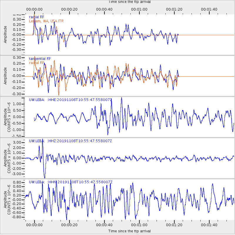
Signal To Noise
| Channel | StoN | STA | LTA |
| UW:LEBA: :HHZ:20191108T10:55:47.558007Z | 7.213933 | 1.122842E-6 | 1.5564908E-7 |
| UW:LEBA: :HHN:20191108T10:55:47.558007Z | 0.9847295 | 2.7820803E-7 | 2.8252228E-7 |
| UW:LEBA: :HHE:20191108T10:55:47.558007Z | 1.9658692 | 3.8320738E-7 | 1.9493025E-7 |
| Arrivals |
| Ps | |
| PpPs | |
| PsPs/PpSs | |


