
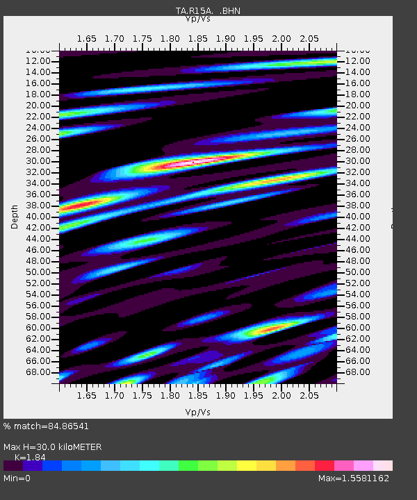
R15A Junction, UT, USA - Earthquake Result Viewer
| ||||||||||||||||||
| ||||||||||||||||||
| ||||||||||||||||||
|
Signal To Noise
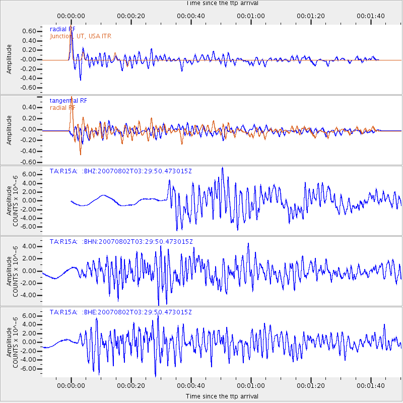
| Channel | StoN | STA | LTA |
| TA:R15A: :BHN:20070802T03:29:50.473015Z | 0.87617797 | 5.8139415E-7 | 6.6355716E-7 |
| TA:R15A: :BHE:20070802T03:29:50.473015Z | 1.4409167 | 9.3662624E-7 | 6.5002115E-7 |
| TA:R15A: :BHZ:20070802T03:29:50.473015Z | 2.5791655 | 1.996877E-6 | 7.742338E-7 |
| Arrivals | |
| Ps | 4.2 SECOND |
| PpPs | 13 SECOND |
| PsPs/PpSs | 17 SECOND |

