R15A Junction, UT, USA - Earthquake Result Viewer
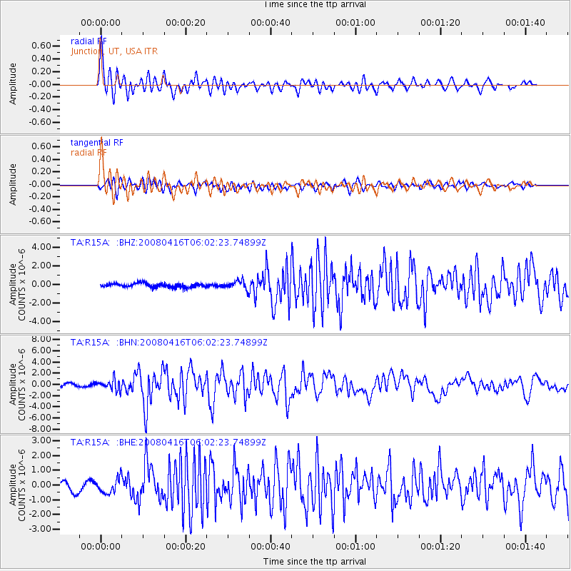
Earthquake location: Andreanof Islands, Aleutian Is.
Earthquake latitude/longitude: 51.9/-179.2
Earthquake time(UTC): 2008/04/16 (107) 05:54:19 GMT
Earthquake Depth: 13 km
Earthquake Magnitude: 6.1 MB, 6.5 MS, 6.6 MW, 6.6 MW
Earthquake Catalog/Contributor: WHDF/NEIC
Network: TA USArray Transportable Network (new EarthScope stations)
Station: R15A Junction, UT, USA
Lat/Lon: 38.21 N/112.28 W
Elevation: 1861 m
Distance: 47.5 deg
Az: 79.123 deg
Baz: 309.395 deg
Ray Param: 0.06991291
Estimated Moho Depth: 38.5 km
Estimated Crust Vp/Vs: 1.61
Assumed Crust Vp: 6.276 km/s
Estimated Crust Vs: 3.892 km/s
Estimated Crust Poisson's Ratio: 0.19
Radial Match: 85.855354 %
Radial Bump: 400
Transverse Match: 76.39869 %
Transverse Bump: 400
SOD ConfigId: 2504
Insert Time: 2010-03-07 05:44:46.418 +0000
GWidth: 2.5
Max Bumps: 400
Tol: 0.001

Signal To Noise

ChannelStoNSTALTA
TA:R15A: :BHN:20080416T06:02:23.74899Z3.43487839.509806E-72.7686005E-7
TA:R15A: :BHE:20080416T06:02:23.74899Z1.63862545.100411E-73.1126154E-7
TA:R15A: :BHZ:20080416T06:02:23.74899Z2.16885734.5565102E-72.1008805E-7
Arrivals
Ps4.0 SECOND
PpPs15 SECOND
PsPs/PpSs19 SECOND