
R15A Junction, UT, USA - Earthquake Result Viewer
| ||||||||||||||||||
| ||||||||||||||||||
| ||||||||||||||||||
|
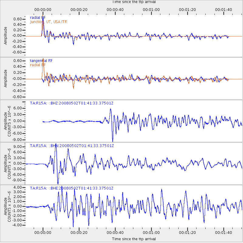
Signal To Noise
| Channel | StoN | STA | LTA |
| TA:R15A: :BHN:20080502T01:41:33.37501Z | 9.871454 | 1.4634187E-6 | 1.4824754E-7 |
| TA:R15A: :BHE:20080502T01:41:33.37501Z | 2.658988 | 4.2398042E-7 | 1.594518E-7 |
| TA:R15A: :BHZ:20080502T01:41:33.37501Z | 3.3876667 | 6.898851E-7 | 2.036461E-7 |
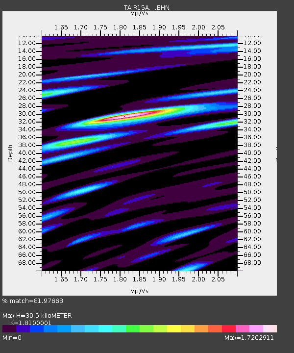
| Arrivals | |
| Ps | 4.2 SECOND |
| PpPs | 13 SECOND |
| PsPs/PpSs | 17 SECOND |

