You are here: Home > Network List > TA - USArray Transportable Network (new EarthScope stations) Stations List
> Station I30M Mount Dempster, Yukon, CAN > Earthquake Result Viewer
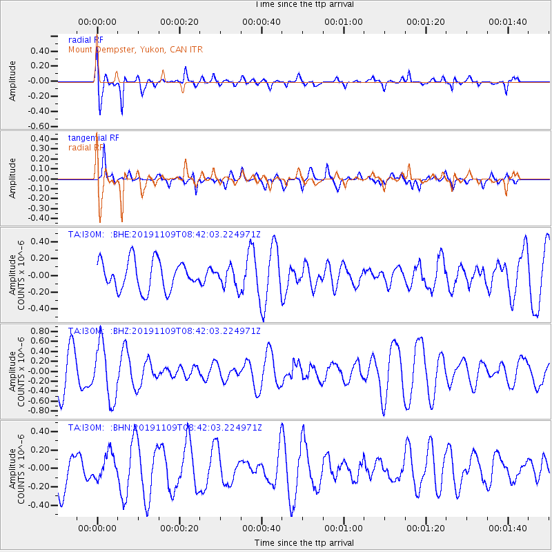
I30M Mount Dempster, Yukon, CAN - Earthquake Result Viewer
*The percent match for this event was below the threshold and hence no stack was calculated.
| Earthquake location: |
Guatemala |
| Earthquake latitude/longitude: |
14.5/-90.3 |
| Earthquake time(UTC): |
2019/11/09 (313) 08:32:52 GMT |
| Earthquake Depth: |
197 km |
| Earthquake Magnitude: |
5.6 Mww |
| Earthquake Catalog/Contributor: |
NEIC PDE/us |
|
| Network: |
TA USArray Transportable Network (new EarthScope stations) |
| Station: |
I30M Mount Dempster, Yukon, CAN |
| Lat/Lon: |
65.22 N/136.38 W |
| Elevation: |
1399 m |
|
| Distance: |
59.4 deg |
| Az: |
339.356 deg |
| Baz: |
125.869 deg |
| Ray Param: |
$rayparam |
*The percent match for this event was below the threshold and hence was not used in the summary stack. |
|
| Radial Match: |
56.57541 % |
| Radial Bump: |
400 |
| Transverse Match: |
67.875694 % |
| Transverse Bump: |
400 |
| SOD ConfigId: |
19951751 |
| Insert Time: |
2019-11-23 08:42:01.002 +0000 |
| GWidth: |
2.5 |
| Max Bumps: |
400 |
| Tol: |
0.001 |
|
Signal To Noise
| Channel | StoN | STA | LTA |
| TA:I30M: :BHZ:20191109T08:42:03.224971Z | 1.9810886 | 5.710164E-7 | 2.8823365E-7 |
| TA:I30M: :BHN:20191109T08:42:03.224971Z | 0.6536474 | 1.4097469E-7 | 2.1567392E-7 |
| TA:I30M: :BHE:20191109T08:42:03.224971Z | 0.7266997 | 1.2578667E-7 | 1.7309306E-7 |
| Arrivals |
| Ps | |
| PpPs | |
| PsPs/PpSs | |


