You are here: Home > Network List > TA - USArray Transportable Network (new EarthScope stations) Stations List
> Station R15A Junction, UT, USA > Earthquake Result Viewer
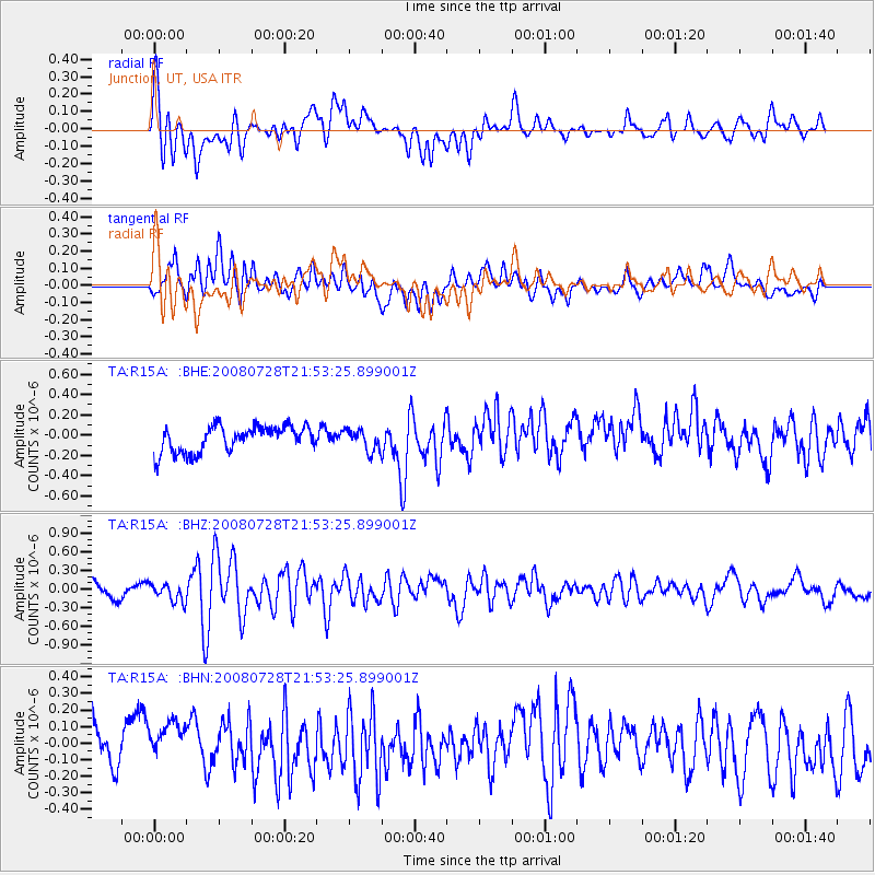
R15A Junction, UT, USA - Earthquake Result Viewer
*The percent match for this event was below the threshold and hence no stack was calculated.
| Earthquake location: |
Solomon Islands |
| Earthquake latitude/longitude: |
-10.6/163.1 |
| Earthquake time(UTC): |
2008/07/28 (210) 21:40:47 GMT |
| Earthquake Depth: |
10 km |
| Earthquake Magnitude: |
5.9 MB, 5.8 MS, 6.0 MW |
| Earthquake Catalog/Contributor: |
WHDF/NEIC |
|
| Network: |
TA USArray Transportable Network (new EarthScope stations) |
| Station: |
R15A Junction, UT, USA |
| Lat/Lon: |
38.21 N/112.28 W |
| Elevation: |
1861 m |
|
| Distance: |
92.3 deg |
| Az: |
51.712 deg |
| Baz: |
258.427 deg |
| Ray Param: |
$rayparam |
*The percent match for this event was below the threshold and hence was not used in the summary stack. |
|
| Radial Match: |
64.196655 % |
| Radial Bump: |
400 |
| Transverse Match: |
64.73396 % |
| Transverse Bump: |
400 |
| SOD ConfigId: |
2504 |
| Insert Time: |
2010-03-07 05:45:20.678 +0000 |
| GWidth: |
2.5 |
| Max Bumps: |
400 |
| Tol: |
0.001 |
|
Signal To Noise
| Channel | StoN | STA | LTA |
| TA:R15A: :BHZ:20080728T21:53:25.899001Z | 1.0498058 | 1.4486712E-7 | 1.379942E-7 |
| TA:R15A: :BHN:20080728T21:53:25.899001Z | 1.0684094 | 1.2663692E-7 | 1.1852844E-7 |
| TA:R15A: :BHE:20080728T21:53:25.899001Z | 0.8197299 | 1.0452877E-7 | 1.2751612E-7 |
| Arrivals |
| Ps | |
| PpPs | |
| PsPs/PpSs | |


