You are here: Home > Network List > TA - USArray Transportable Network (new EarthScope stations) Stations List
> Station R15A Junction, UT, USA > Earthquake Result Viewer
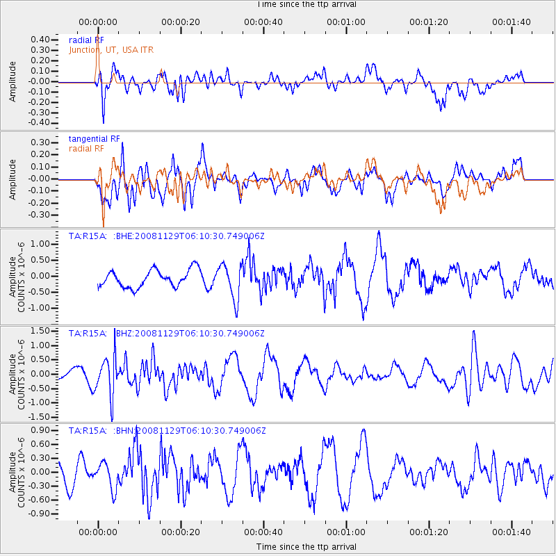
R15A Junction, UT, USA - Earthquake Result Viewer
*The percent match for this event was below the threshold and hence no stack was calculated.
| Earthquake location: |
Fiji Islands Region |
| Earthquake latitude/longitude: |
-18.7/-177.7 |
| Earthquake time(UTC): |
2008/11/29 (334) 05:59:16 GMT |
| Earthquake Depth: |
386 km |
| Earthquake Magnitude: |
5.7 MB, 6.0 MW, 5.9 MW |
| Earthquake Catalog/Contributor: |
WHDF/NEIC |
|
| Network: |
TA USArray Transportable Network (new EarthScope stations) |
| Station: |
R15A Junction, UT, USA |
| Lat/Lon: |
38.21 N/112.28 W |
| Elevation: |
1861 m |
|
| Distance: |
83.5 deg |
| Az: |
46.152 deg |
| Baz: |
240.199 deg |
| Ray Param: |
$rayparam |
*The percent match for this event was below the threshold and hence was not used in the summary stack. |
|
| Radial Match: |
60.275833 % |
| Radial Bump: |
400 |
| Transverse Match: |
71.18154 % |
| Transverse Bump: |
400 |
| SOD ConfigId: |
2658 |
| Insert Time: |
2010-03-07 05:45:39.662 +0000 |
| GWidth: |
2.5 |
| Max Bumps: |
400 |
| Tol: |
0.001 |
|
Signal To Noise
| Channel | StoN | STA | LTA |
| TA:R15A: :BHZ:20081129T06:10:30.749006Z | 2.9157734 | 6.884858E-7 | 2.3612456E-7 |
| TA:R15A: :BHN:20081129T06:10:30.749006Z | 1.1538136 | 2.864379E-7 | 2.4825317E-7 |
| TA:R15A: :BHE:20081129T06:10:30.749006Z | 2.1259115 | 5.674192E-7 | 2.669063E-7 |
| Arrivals |
| Ps | |
| PpPs | |
| PsPs/PpSs | |


