You are here: Home > Network List > TA - USArray Transportable Network (new EarthScope stations) Stations List
> Station R15A Junction, UT, USA > Earthquake Result Viewer
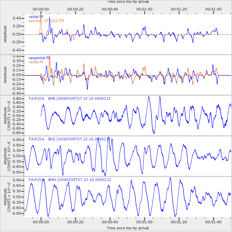
R15A Junction, UT, USA - Earthquake Result Viewer
*The percent match for this event was below the threshold and hence no stack was calculated.
| Earthquake location: |
Tonga Islands |
| Earthquake latitude/longitude: |
-15.2/-173.3 |
| Earthquake time(UTC): |
2009/03/06 (065) 07:01:48 GMT |
| Earthquake Depth: |
3.0 km |
| Earthquake Magnitude: |
5.5 MB, 5.4 MS, 5.8 MW, 5.8 MW |
| Earthquake Catalog/Contributor: |
WHDF/NEIC |
|
| Network: |
TA USArray Transportable Network (new EarthScope stations) |
| Station: |
R15A Junction, UT, USA |
| Lat/Lon: |
38.21 N/112.28 W |
| Elevation: |
1861 m |
|
| Distance: |
78.0 deg |
| Az: |
44.803 deg |
| Baz: |
239.747 deg |
| Ray Param: |
$rayparam |
*The percent match for this event was below the threshold and hence was not used in the summary stack. |
|
| Radial Match: |
75.96505 % |
| Radial Bump: |
400 |
| Transverse Match: |
78.10896 % |
| Transverse Bump: |
400 |
| SOD ConfigId: |
2658 |
| Insert Time: |
2010-03-07 05:45:40.612 +0000 |
| GWidth: |
2.5 |
| Max Bumps: |
400 |
| Tol: |
0.001 |
|
Signal To Noise
| Channel | StoN | STA | LTA |
| TA:R15A: :BHZ:20090306T07:13:16.099021Z | 0.979029 | 3.1754587E-7 | 3.2434778E-7 |
| TA:R15A: :BHN:20090306T07:13:16.099021Z | 1.9531192 | 6.93078E-7 | 3.54857E-7 |
| TA:R15A: :BHE:20090306T07:13:16.099021Z | 0.68056685 | 1.8993694E-7 | 2.7908638E-7 |
| Arrivals |
| Ps | |
| PpPs | |
| PsPs/PpSs | |


