You are here: Home > Network List > US - United States National Seismic Network Stations List
> Station WUAZ Wupatki, Arizona, USA > Earthquake Result Viewer
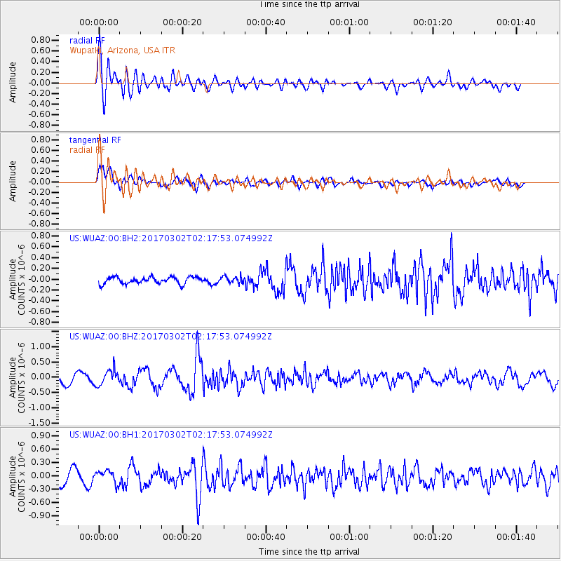
WUAZ Wupatki, Arizona, USA - Earthquake Result Viewer
*The percent match for this event was below the threshold and hence no stack was calculated.
| Earthquake location: |
Southern Alaska |
| Earthquake latitude/longitude: |
59.6/-152.6 |
| Earthquake time(UTC): |
2017/03/02 (061) 02:11:30 GMT |
| Earthquake Depth: |
77 km |
| Earthquake Magnitude: |
5.5 Ml |
| Earthquake Catalog/Contributor: |
NEIC PDE/ak |
|
| Network: |
US United States National Seismic Network |
| Station: |
WUAZ Wupatki, Arizona, USA |
| Lat/Lon: |
35.52 N/111.37 W |
| Elevation: |
1592 m |
|
| Distance: |
35.9 deg |
| Az: |
113.505 deg |
| Baz: |
325.116 deg |
| Ray Param: |
$rayparam |
*The percent match for this event was below the threshold and hence was not used in the summary stack. |
|
| Radial Match: |
79.380226 % |
| Radial Bump: |
400 |
| Transverse Match: |
76.94793 % |
| Transverse Bump: |
400 |
| SOD ConfigId: |
1992691 |
| Insert Time: |
2017-03-16 02:15:44.968 +0000 |
| GWidth: |
2.5 |
| Max Bumps: |
400 |
| Tol: |
0.001 |
|
Signal To Noise
| Channel | StoN | STA | LTA |
| US:WUAZ:00:BHZ:20170302T02:17:53.074992Z | 2.1112363 | 2.530578E-7 | 1.1986238E-7 |
| US:WUAZ:00:BH1:20170302T02:17:53.074992Z | 1.1676103 | 1.4677826E-7 | 1.2570827E-7 |
| US:WUAZ:00:BH2:20170302T02:17:53.074992Z | 0.96655077 | 6.029071E-8 | 6.2377175E-8 |
| Arrivals |
| Ps | |
| PpPs | |
| PsPs/PpSs | |


