You are here: Home > Network List > TA - USArray Transportable Network (new EarthScope stations) Stations List
> Station R15A Junction, UT, USA > Earthquake Result Viewer
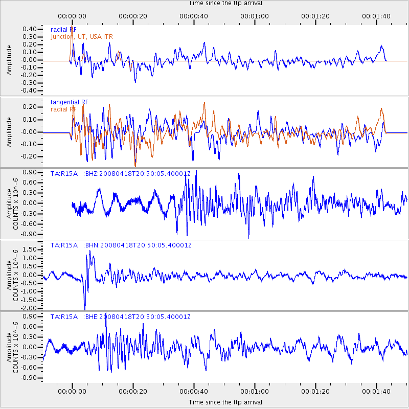
R15A Junction, UT, USA - Earthquake Result Viewer
*The percent match for this event was below the threshold and hence no stack was calculated.
| Earthquake location: |
Fiji Islands Region |
| Earthquake latitude/longitude: |
-17.3/-179.0 |
| Earthquake time(UTC): |
2008/04/18 (109) 20:39:07 GMT |
| Earthquake Depth: |
554 km |
| Earthquake Magnitude: |
5.9 MB, 6.3 MW, 6.3 MW |
| Earthquake Catalog/Contributor: |
WHDF/NEIC |
|
| Network: |
TA USArray Transportable Network (new EarthScope stations) |
| Station: |
R15A Junction, UT, USA |
| Lat/Lon: |
38.21 N/112.28 W |
| Elevation: |
1861 m |
|
| Distance: |
83.4 deg |
| Az: |
46.765 deg |
| Baz: |
242.047 deg |
| Ray Param: |
$rayparam |
*The percent match for this event was below the threshold and hence was not used in the summary stack. |
|
| Radial Match: |
53.076035 % |
| Radial Bump: |
400 |
| Transverse Match: |
55.525913 % |
| Transverse Bump: |
400 |
| SOD ConfigId: |
2504 |
| Insert Time: |
2010-03-07 05:45:50.079 +0000 |
| GWidth: |
2.5 |
| Max Bumps: |
400 |
| Tol: |
0.001 |
|
Signal To Noise
| Channel | StoN | STA | LTA |
| TA:R15A: :BHN:20080418T20:50:05.40001Z | 5.437488 | 6.3621684E-7 | 1.1700566E-7 |
| TA:R15A: :BHE:20080418T20:50:05.40001Z | 0.73168397 | 9.5509535E-8 | 1.3053386E-7 |
| TA:R15A: :BHZ:20080418T20:50:05.40001Z | 1.5838397 | 2.8458385E-7 | 1.796797E-7 |
| Arrivals |
| Ps | |
| PpPs | |
| PsPs/PpSs | |


