You are here: Home > Network List > TA - USArray Transportable Network (new EarthScope stations) Stations List
> Station R15A Junction, UT, USA > Earthquake Result Viewer
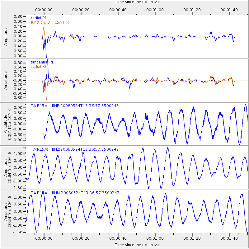
R15A Junction, UT, USA - Earthquake Result Viewer
*The percent match for this event was below the threshold and hence no stack was calculated.
| Earthquake location: |
Solomon Islands |
| Earthquake latitude/longitude: |
-7.2/156.1 |
| Earthquake time(UTC): |
2008/05/24 (145) 13:24:05 GMT |
| Earthquake Depth: |
29 km |
| Earthquake Magnitude: |
5.8 MB, 5.5 MS, 5.9 MW, 5.8 MW |
| Earthquake Catalog/Contributor: |
WHDF/NEIC |
|
| Network: |
TA USArray Transportable Network (new EarthScope stations) |
| Station: |
R15A Junction, UT, USA |
| Lat/Lon: |
38.21 N/112.28 W |
| Elevation: |
1861 m |
|
| Distance: |
95.7 deg |
| Az: |
52.309 deg |
| Baz: |
265.378 deg |
| Ray Param: |
$rayparam |
*The percent match for this event was below the threshold and hence was not used in the summary stack. |
|
| Radial Match: |
84.6357 % |
| Radial Bump: |
400 |
| Transverse Match: |
87.85561 % |
| Transverse Bump: |
400 |
| SOD ConfigId: |
2504 |
| Insert Time: |
2010-03-07 05:45:52.922 +0000 |
| GWidth: |
2.5 |
| Max Bumps: |
400 |
| Tol: |
0.001 |
|
Signal To Noise
| Channel | StoN | STA | LTA |
| TA:R15A: :BHZ:20080524T13:36:57.350024Z | 1.384349 | 6.492064E-7 | 4.6896153E-7 |
| TA:R15A: :BHN:20080524T13:36:57.350024Z | 2.099662 | 9.835102E-7 | 4.684135E-7 |
| TA:R15A: :BHE:20080524T13:36:57.350024Z | 0.6970984 | 2.7492732E-7 | 3.943881E-7 |
| Arrivals |
| Ps | |
| PpPs | |
| PsPs/PpSs | |


