You are here: Home > Network List > TA - USArray Transportable Network (new EarthScope stations) Stations List
> Station R15A Junction, UT, USA > Earthquake Result Viewer
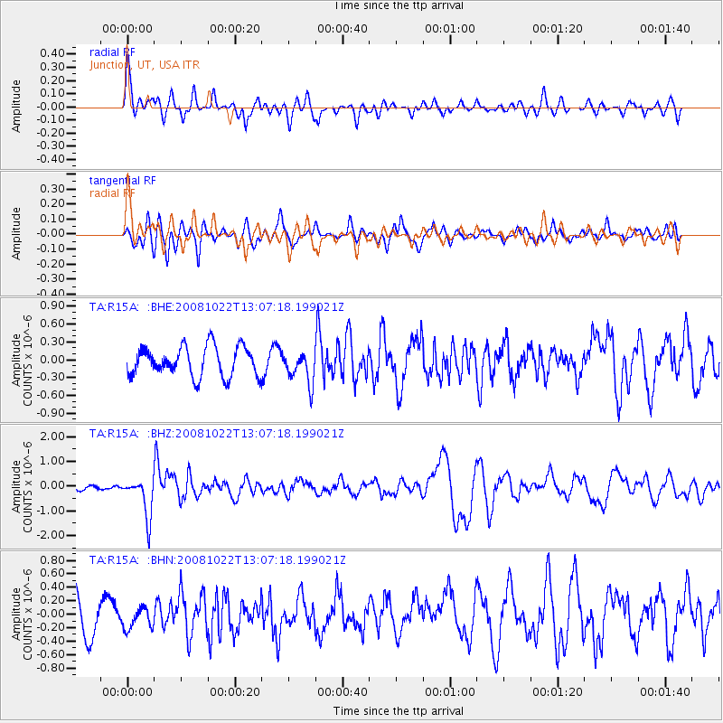
R15A Junction, UT, USA - Earthquake Result Viewer
*The percent match for this event was below the threshold and hence no stack was calculated.
| Earthquake location: |
Tonga Islands |
| Earthquake latitude/longitude: |
-18.4/-175.4 |
| Earthquake time(UTC): |
2008/10/22 (296) 12:55:57 GMT |
| Earthquake Depth: |
233 km |
| Earthquake Magnitude: |
5.9 MB, 6.4 MW, 6.3 MW |
| Earthquake Catalog/Contributor: |
WHDF/NEIC |
|
| Network: |
TA USArray Transportable Network (new EarthScope stations) |
| Station: |
R15A Junction, UT, USA |
| Lat/Lon: |
38.21 N/112.28 W |
| Elevation: |
1861 m |
|
| Distance: |
81.6 deg |
| Az: |
45.226 deg |
| Baz: |
238.824 deg |
| Ray Param: |
$rayparam |
*The percent match for this event was below the threshold and hence was not used in the summary stack. |
|
| Radial Match: |
65.881615 % |
| Radial Bump: |
400 |
| Transverse Match: |
65.84548 % |
| Transverse Bump: |
400 |
| SOD ConfigId: |
2658 |
| Insert Time: |
2010-03-07 05:46:00.793 +0000 |
| GWidth: |
2.5 |
| Max Bumps: |
400 |
| Tol: |
0.001 |
|
Signal To Noise
| Channel | StoN | STA | LTA |
| TA:R15A: :BHZ:20081022T13:07:18.199021Z | 6.4171634 | 7.961255E-7 | 1.240619E-7 |
| TA:R15A: :BHN:20081022T13:07:18.199021Z | 0.6899269 | 1.5808143E-7 | 2.2912778E-7 |
| TA:R15A: :BHE:20081022T13:07:18.199021Z | 1.0885547 | 2.705516E-7 | 2.4854202E-7 |
| Arrivals |
| Ps | |
| PpPs | |
| PsPs/PpSs | |


