You are here: Home > Network List > TA - USArray Transportable Network (new EarthScope stations) Stations List
> Station R15A Junction, UT, USA > Earthquake Result Viewer
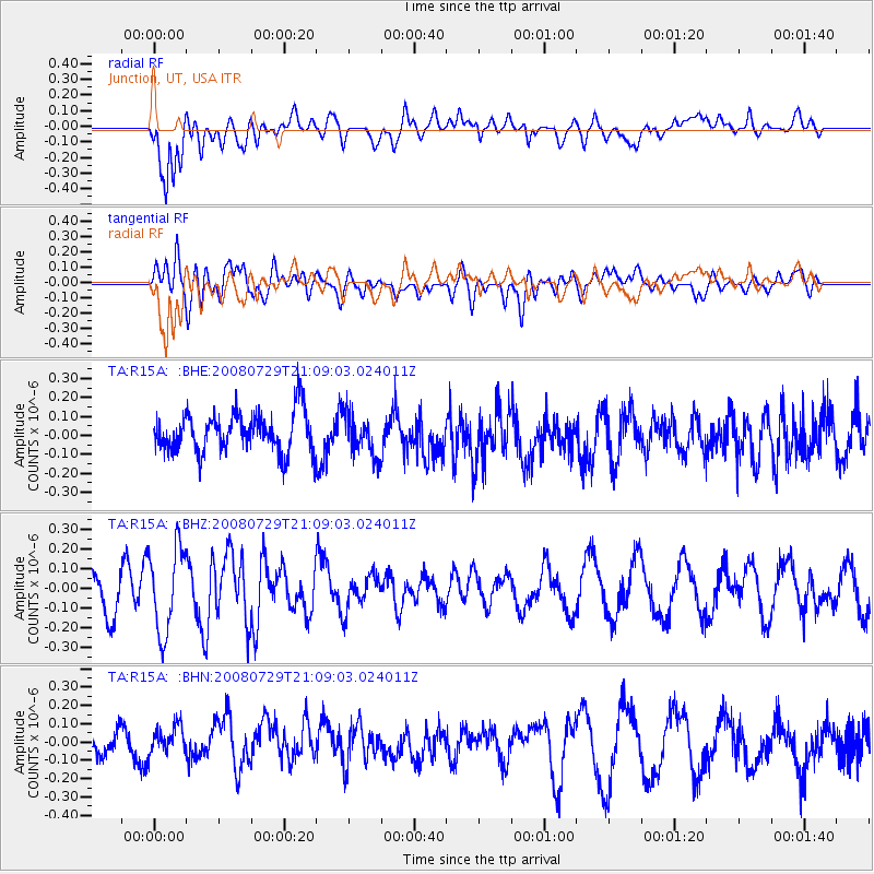
R15A Junction, UT, USA - Earthquake Result Viewer
*The percent match for this event was below the threshold and hence no stack was calculated.
| Earthquake location: |
Southern East Pacific Rise |
| Earthquake latitude/longitude: |
-54.7/-118.8 |
| Earthquake time(UTC): |
2008/07/29 (211) 20:56:22 GMT |
| Earthquake Depth: |
10 km |
| Earthquake Magnitude: |
5.5 MB, 5.4 MS, 5.8 MW, 5.7 MW |
| Earthquake Catalog/Contributor: |
WHDF/NEIC |
|
| Network: |
TA USArray Transportable Network (new EarthScope stations) |
| Station: |
R15A Junction, UT, USA |
| Lat/Lon: |
38.21 N/112.28 W |
| Elevation: |
1861 m |
|
| Distance: |
92.7 deg |
| Az: |
5.127 deg |
| Baz: |
183.773 deg |
| Ray Param: |
$rayparam |
*The percent match for this event was below the threshold and hence was not used in the summary stack. |
|
| Radial Match: |
74.32314 % |
| Radial Bump: |
400 |
| Transverse Match: |
57.52871 % |
| Transverse Bump: |
400 |
| SOD ConfigId: |
2504 |
| Insert Time: |
2010-03-07 05:46:01.482 +0000 |
| GWidth: |
2.5 |
| Max Bumps: |
400 |
| Tol: |
0.001 |
|
Signal To Noise
| Channel | StoN | STA | LTA |
| TA:R15A: :BHZ:20080729T21:09:03.024011Z | 2.093295 | 2.1825537E-7 | 1.04264025E-7 |
| TA:R15A: :BHN:20080729T21:09:03.024011Z | 0.8717452 | 7.548626E-8 | 8.659212E-8 |
| TA:R15A: :BHE:20080729T21:09:03.024011Z | 1.0378596 | 1.0860935E-7 | 1.0464744E-7 |
| Arrivals |
| Ps | |
| PpPs | |
| PsPs/PpSs | |


