You are here: Home > Network List > TA - USArray Transportable Network (new EarthScope stations) Stations List
> Station B18K Kokolik River, AK, USA > Earthquake Result Viewer
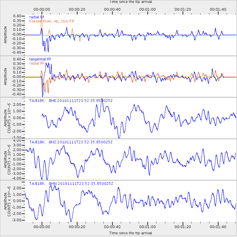
B18K Kokolik River, AK, USA - Earthquake Result Viewer
*The percent match for this event was below the threshold and hence no stack was calculated.
| Earthquake location: |
Halmahera, Indonesia |
| Earthquake latitude/longitude: |
1.4/127.0 |
| Earthquake time(UTC): |
2019/11/11 (315) 23:40:59 GMT |
| Earthquake Depth: |
118 km |
| Earthquake Magnitude: |
5.3 Mww |
| Earthquake Catalog/Contributor: |
NEIC PDE/us |
|
| Network: |
TA USArray Transportable Network (new EarthScope stations) |
| Station: |
B18K Kokolik River, AK, USA |
| Lat/Lon: |
69.36 N/161.80 W |
| Elevation: |
222 m |
|
| Distance: |
82.1 deg |
| Az: |
19.799 deg |
| Baz: |
252.786 deg |
| Ray Param: |
$rayparam |
*The percent match for this event was below the threshold and hence was not used in the summary stack. |
|
| Radial Match: |
89.43807 % |
| Radial Bump: |
356 |
| Transverse Match: |
84.368484 % |
| Transverse Bump: |
400 |
| SOD ConfigId: |
19951751 |
| Insert Time: |
2019-11-25 23:48:03.698 +0000 |
| GWidth: |
2.5 |
| Max Bumps: |
400 |
| Tol: |
0.001 |
|
Signal To Noise
| Channel | StoN | STA | LTA |
| TA:B18K: :BHZ:20191111T23:52:35.850025Z | 2.002075 | 2.9253915E-6 | 1.4611796E-6 |
| TA:B18K: :BHN:20191111T23:52:35.850025Z | 0.9975023 | 1.4070623E-6 | 1.4105856E-6 |
| TA:B18K: :BHE:20191111T23:52:35.850025Z | 1.7187037 | 1.6132838E-6 | 9.386631E-7 |
| Arrivals |
| Ps | |
| PpPs | |
| PsPs/PpSs | |


