You are here: Home > Network List > TA - USArray Transportable Network (new EarthScope stations) Stations List
> Station E20K Nigu River, AK, USA > Earthquake Result Viewer
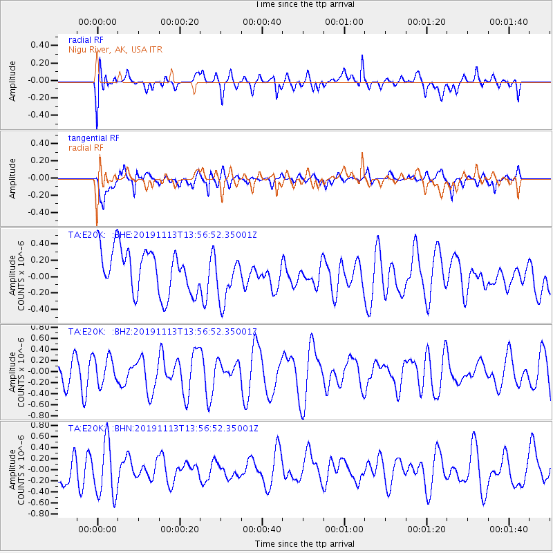
E20K Nigu River, AK, USA - Earthquake Result Viewer
*The percent match for this event was below the threshold and hence no stack was calculated.
| Earthquake location: |
Central Mid-Atlantic Ridge |
| Earthquake latitude/longitude: |
7.3/-35.4 |
| Earthquake time(UTC): |
2019/11/13 (317) 13:44:05 GMT |
| Earthquake Depth: |
10 km |
| Earthquake Magnitude: |
5.5 Mww |
| Earthquake Catalog/Contributor: |
NEIC PDE/us |
|
| Network: |
TA USArray Transportable Network (new EarthScope stations) |
| Station: |
E20K Nigu River, AK, USA |
| Lat/Lon: |
68.26 N/156.19 W |
| Elevation: |
866 m |
|
| Distance: |
94.1 deg |
| Az: |
341.277 deg |
| Baz: |
58.721 deg |
| Ray Param: |
$rayparam |
*The percent match for this event was below the threshold and hence was not used in the summary stack. |
|
| Radial Match: |
49.676785 % |
| Radial Bump: |
400 |
| Transverse Match: |
60.69219 % |
| Transverse Bump: |
400 |
| SOD ConfigId: |
19951751 |
| Insert Time: |
2019-11-27 13:57:19.264 +0000 |
| GWidth: |
2.5 |
| Max Bumps: |
400 |
| Tol: |
0.001 |
|
Signal To Noise
| Channel | StoN | STA | LTA |
| TA:E20K: :BHZ:20191113T13:56:52.35001Z | 0.93143445 | 2.3824913E-7 | 2.5578734E-7 |
| TA:E20K: :BHN:20191113T13:56:52.35001Z | 2.26926 | 5.146129E-7 | 2.2677564E-7 |
| TA:E20K: :BHE:20191113T13:56:52.35001Z | 1.0828375 | 2.896366E-7 | 2.6747927E-7 |
| Arrivals |
| Ps | |
| PpPs | |
| PsPs/PpSs | |


