You are here: Home > Network List > TA - USArray Transportable Network (new EarthScope stations) Stations List
> Station Q24A Divide, CO, USA > Earthquake Result Viewer
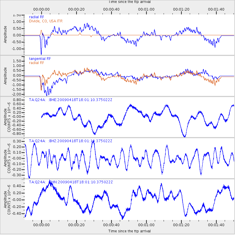
Q24A Divide, CO, USA - Earthquake Result Viewer
*The percent match for this event was below the threshold and hence no stack was calculated.
| Earthquake location: |
Fiji Islands Region |
| Earthquake latitude/longitude: |
-20.6/-178.5 |
| Earthquake time(UTC): |
2009/04/18 (108) 17:49:39 GMT |
| Earthquake Depth: |
566 km |
| Earthquake Magnitude: |
5.7 MW, 5.0 MB, 5.7 MW |
| Earthquake Catalog/Contributor: |
WHDF/NEIC |
|
| Network: |
TA USArray Transportable Network (new EarthScope stations) |
| Station: |
Q24A Divide, CO, USA |
| Lat/Lon: |
38.96 N/105.15 W |
| Elevation: |
2775 m |
|
| Distance: |
90.6 deg |
| Az: |
48.321 deg |
| Baz: |
243.824 deg |
| Ray Param: |
$rayparam |
*The percent match for this event was below the threshold and hence was not used in the summary stack. |
|
| Radial Match: |
73.11892 % |
| Radial Bump: |
400 |
| Transverse Match: |
83.28204 % |
| Transverse Bump: |
400 |
| SOD ConfigId: |
2658 |
| Insert Time: |
2010-03-07 05:48:10.385 +0000 |
| GWidth: |
2.5 |
| Max Bumps: |
400 |
| Tol: |
0.001 |
|
Signal To Noise
| Channel | StoN | STA | LTA |
| TA:Q24A: :BHZ:20090418T18:01:10.375022Z | 0.6564208 | 9.904826E-8 | 1.508914E-7 |
| TA:Q24A: :BHN:20090418T18:01:10.375022Z | 2.0785303 | 4.4581756E-7 | 2.1448692E-7 |
| TA:Q24A: :BHE:20090418T18:01:10.375022Z | 3.440834 | 7.175653E-7 | 2.08544E-7 |
| Arrivals |
| Ps | |
| PpPs | |
| PsPs/PpSs | |


