You are here: Home > Network List > TA - USArray Transportable Network (new EarthScope stations) Stations List
> Station F21K Alatna River, AK, USA > Earthquake Result Viewer
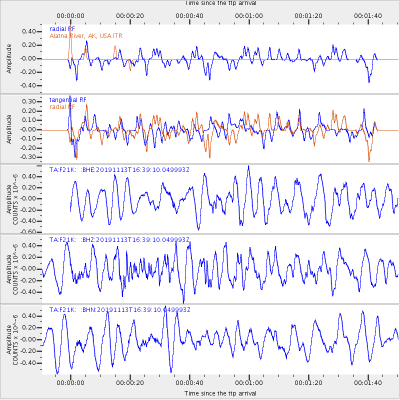
F21K Alatna River, AK, USA - Earthquake Result Viewer
*The percent match for this event was below the threshold and hence no stack was calculated.
| Earthquake location: |
Near Coast Of Guatemala |
| Earthquake latitude/longitude: |
13.7/-91.0 |
| Earthquake time(UTC): |
2019/11/13 (317) 16:28:54 GMT |
| Earthquake Depth: |
61 km |
| Earthquake Magnitude: |
5.5 Mww |
| Earthquake Catalog/Contributor: |
NEIC PDE/us |
|
| Network: |
TA USArray Transportable Network (new EarthScope stations) |
| Station: |
F21K Alatna River, AK, USA |
| Lat/Lon: |
67.22 N/153.48 W |
| Elevation: |
597 m |
|
| Distance: |
67.0 deg |
| Az: |
337.956 deg |
| Baz: |
110.457 deg |
| Ray Param: |
$rayparam |
*The percent match for this event was below the threshold and hence was not used in the summary stack. |
|
| Radial Match: |
46.712585 % |
| Radial Bump: |
400 |
| Transverse Match: |
58.928383 % |
| Transverse Bump: |
400 |
| SOD ConfigId: |
19951751 |
| Insert Time: |
2019-11-27 16:44:07.339 +0000 |
| GWidth: |
2.5 |
| Max Bumps: |
400 |
| Tol: |
0.001 |
|
Signal To Noise
| Channel | StoN | STA | LTA |
| TA:F21K: :BHZ:20191113T16:39:10.049993Z | 1.3521878 | 1.8353307E-7 | 1.3573046E-7 |
| TA:F21K: :BHN:20191113T16:39:10.049993Z | 1.9546862 | 3.3084024E-7 | 1.6925492E-7 |
| TA:F21K: :BHE:20191113T16:39:10.049993Z | 0.7197386 | 1.6252893E-7 | 2.258166E-7 |
| Arrivals |
| Ps | |
| PpPs | |
| PsPs/PpSs | |


