You are here: Home > Network List > TA - USArray Transportable Network (new EarthScope stations) Stations List
> Station C16K Lisburne Hills, AK, USA > Earthquake Result Viewer
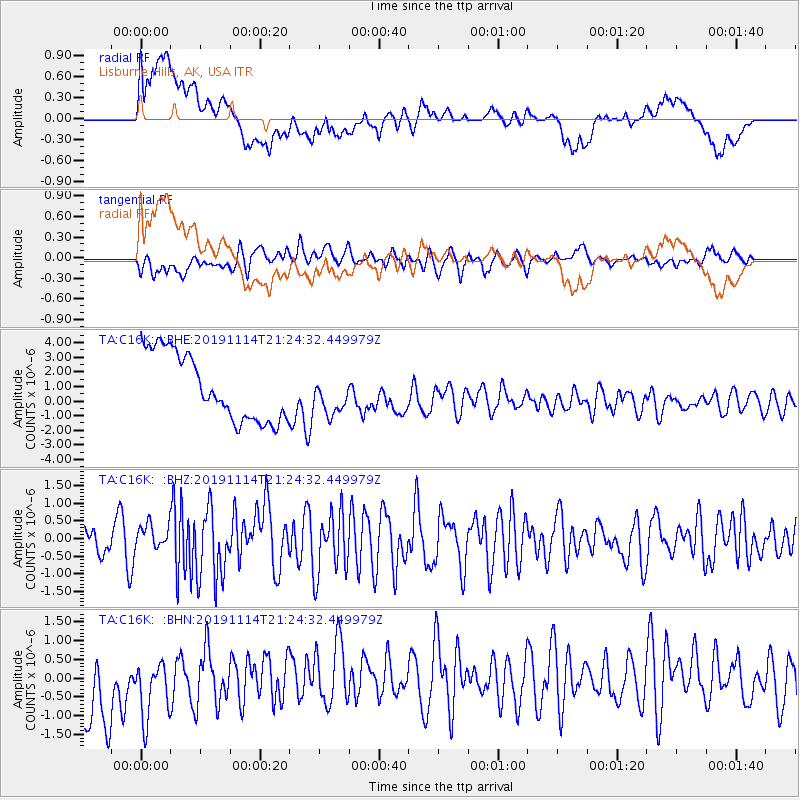
C16K Lisburne Hills, AK, USA - Earthquake Result Viewer
*The percent match for this event was below the threshold and hence no stack was calculated.
| Earthquake location: |
Northern Molucca Sea |
| Earthquake latitude/longitude: |
1.6/126.5 |
| Earthquake time(UTC): |
2019/11/14 (318) 21:12:53 GMT |
| Earthquake Depth: |
22 km |
| Earthquake Magnitude: |
5.8 Mww |
| Earthquake Catalog/Contributor: |
NEIC PDE/us |
|
| Network: |
TA USArray Transportable Network (new EarthScope stations) |
| Station: |
C16K Lisburne Hills, AK, USA |
| Lat/Lon: |
68.27 N/165.34 W |
| Elevation: |
102 m |
|
| Distance: |
80.6 deg |
| Az: |
20.511 deg |
| Baz: |
250.179 deg |
| Ray Param: |
$rayparam |
*The percent match for this event was below the threshold and hence was not used in the summary stack. |
|
| Radial Match: |
29.67954 % |
| Radial Bump: |
400 |
| Transverse Match: |
42.069664 % |
| Transverse Bump: |
400 |
| SOD ConfigId: |
19951751 |
| Insert Time: |
2019-11-28 21:20:21.716 +0000 |
| GWidth: |
2.5 |
| Max Bumps: |
400 |
| Tol: |
0.001 |
|
Signal To Noise
| Channel | StoN | STA | LTA |
| TA:C16K: :BHZ:20191114T21:24:32.449979Z | 0.86017287 | 3.4586805E-7 | 4.0209133E-7 |
| TA:C16K: :BHN:20191114T21:24:32.449979Z | 0.720345 | 1.1757766E-6 | 1.6322409E-6 |
| TA:C16K: :BHE:20191114T21:24:32.449979Z | 0.57557243 | 1.3148452E-6 | 2.284413E-6 |
| Arrivals |
| Ps | |
| PpPs | |
| PsPs/PpSs | |


