You are here: Home > Network List > TA - USArray Transportable Network (new EarthScope stations) Stations List
> Station E20K Nigu River, AK, USA > Earthquake Result Viewer
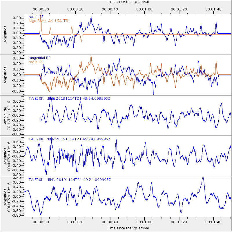
E20K Nigu River, AK, USA - Earthquake Result Viewer
*The percent match for this event was below the threshold and hence no stack was calculated.
| Earthquake location: |
Northern Molucca Sea |
| Earthquake latitude/longitude: |
1.4/126.4 |
| Earthquake time(UTC): |
2019/11/14 (318) 21:37:27 GMT |
| Earthquake Depth: |
28 km |
| Earthquake Magnitude: |
5.4 Mww |
| Earthquake Catalog/Contributor: |
NEIC PDE/us |
|
| Network: |
TA USArray Transportable Network (new EarthScope stations) |
| Station: |
E20K Nigu River, AK, USA |
| Lat/Lon: |
68.26 N/156.19 W |
| Elevation: |
866 m |
|
| Distance: |
84.0 deg |
| Az: |
21.444 deg |
| Baz: |
258.799 deg |
| Ray Param: |
$rayparam |
*The percent match for this event was below the threshold and hence was not used in the summary stack. |
|
| Radial Match: |
54.56017 % |
| Radial Bump: |
400 |
| Transverse Match: |
51.17994 % |
| Transverse Bump: |
400 |
| SOD ConfigId: |
19951751 |
| Insert Time: |
2019-11-28 21:43:42.396 +0000 |
| GWidth: |
2.5 |
| Max Bumps: |
400 |
| Tol: |
0.001 |
|
Signal To Noise
| Channel | StoN | STA | LTA |
| TA:E20K: :BHZ:20191114T21:49:24.099995Z | 1.693156 | 3.636016E-7 | 2.1474784E-7 |
| TA:E20K: :BHN:20191114T21:49:24.099995Z | 2.0264182 | 4.5895885E-7 | 2.2648773E-7 |
| TA:E20K: :BHE:20191114T21:49:24.099995Z | 1.1602666 | 3.0948377E-7 | 2.6673504E-7 |
| Arrivals |
| Ps | |
| PpPs | |
| PsPs/PpSs | |


