You are here: Home > Network List > CN - Canadian National Seismograph Network Stations List
> Station INK INUVIK, NT > Earthquake Result Viewer
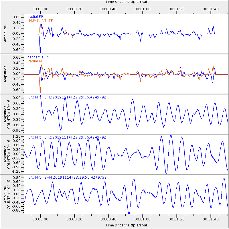
INK INUVIK, NT - Earthquake Result Viewer
*The percent match for this event was below the threshold and hence no stack was calculated.
| Earthquake location: |
Northern Molucca Sea |
| Earthquake latitude/longitude: |
1.6/126.4 |
| Earthquake time(UTC): |
2019/11/14 (318) 23:17:22 GMT |
| Earthquake Depth: |
41 km |
| Earthquake Magnitude: |
5.5 Mww |
| Earthquake Catalog/Contributor: |
NEIC PDE/us |
|
| Network: |
CN Canadian National Seismograph Network |
| Station: |
INK INUVIK, NT |
| Lat/Lon: |
68.31 N/133.53 W |
| Elevation: |
44 m |
|
| Distance: |
92.2 deg |
| Az: |
21.487 deg |
| Baz: |
279.989 deg |
| Ray Param: |
$rayparam |
*The percent match for this event was below the threshold and hence was not used in the summary stack. |
|
| Radial Match: |
68.51447 % |
| Radial Bump: |
400 |
| Transverse Match: |
49.861996 % |
| Transverse Bump: |
400 |
| SOD ConfigId: |
19951751 |
| Insert Time: |
2019-11-28 23:21:40.210 +0000 |
| GWidth: |
2.5 |
| Max Bumps: |
400 |
| Tol: |
0.001 |
|
Signal To Noise
| Channel | StoN | STA | LTA |
| CN:INK: :BHZ:20191114T23:29:56.424979Z | 2.2490025 | 7.4740007E-7 | 3.3232513E-7 |
| CN:INK: :BHN:20191114T23:29:56.424979Z | 0.97898424 | 2.7168835E-7 | 2.7752066E-7 |
| CN:INK: :BHE:20191114T23:29:56.424979Z | 0.5264677 | 2.2996532E-7 | 4.3680805E-7 |
| Arrivals |
| Ps | |
| PpPs | |
| PsPs/PpSs | |


