You are here: Home > Network List > TA - USArray Transportable Network (new EarthScope stations) Stations List
> Station E20K Nigu River, AK, USA > Earthquake Result Viewer
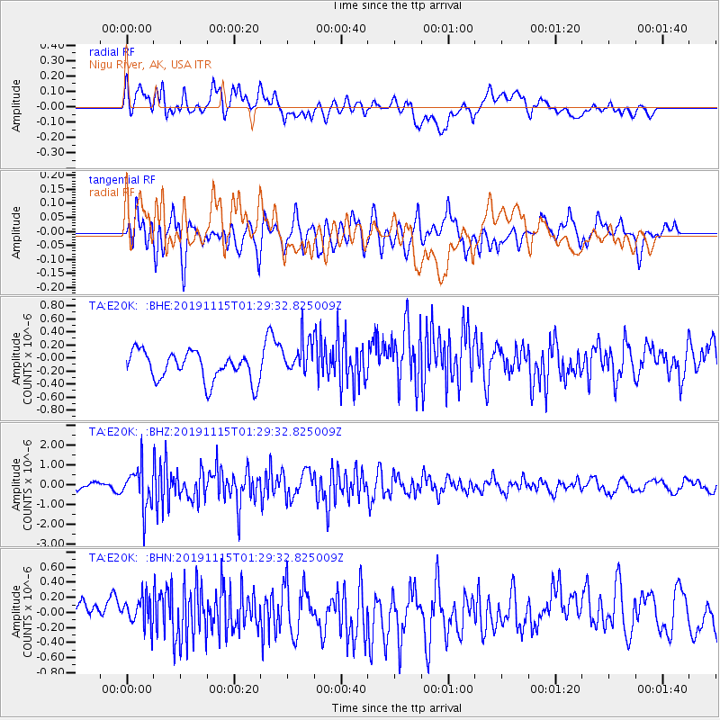
E20K Nigu River, AK, USA - Earthquake Result Viewer
*The percent match for this event was below the threshold and hence no stack was calculated.
| Earthquake location: |
Northern Molucca Sea |
| Earthquake latitude/longitude: |
1.6/126.4 |
| Earthquake time(UTC): |
2019/11/15 (319) 01:17:38 GMT |
| Earthquake Depth: |
44 km |
| Earthquake Magnitude: |
5.9 Mww |
| Earthquake Catalog/Contributor: |
NEIC PDE/us |
|
| Network: |
TA USArray Transportable Network (new EarthScope stations) |
| Station: |
E20K Nigu River, AK, USA |
| Lat/Lon: |
68.26 N/156.19 W |
| Elevation: |
866 m |
|
| Distance: |
83.9 deg |
| Az: |
21.456 deg |
| Baz: |
258.918 deg |
| Ray Param: |
$rayparam |
*The percent match for this event was below the threshold and hence was not used in the summary stack. |
|
| Radial Match: |
47.434383 % |
| Radial Bump: |
400 |
| Transverse Match: |
57.734543 % |
| Transverse Bump: |
400 |
| SOD ConfigId: |
19951751 |
| Insert Time: |
2019-11-29 01:26:58.506 +0000 |
| GWidth: |
2.5 |
| Max Bumps: |
400 |
| Tol: |
0.001 |
|
Signal To Noise
| Channel | StoN | STA | LTA |
| TA:E20K: :BHZ:20191115T01:29:32.825009Z | 4.905093 | 1.0045845E-6 | 2.0480437E-7 |
| TA:E20K: :BHN:20191115T01:29:32.825009Z | 0.88872707 | 2.1201207E-7 | 2.3855702E-7 |
| TA:E20K: :BHE:20191115T01:29:32.825009Z | 1.3029995 | 2.8440698E-7 | 2.1827098E-7 |
| Arrivals |
| Ps | |
| PpPs | |
| PsPs/PpSs | |


