You are here: Home > Network List > TA - USArray Transportable Network (new EarthScope stations) Stations List
> Station G21K Allakaket, AK, USA > Earthquake Result Viewer
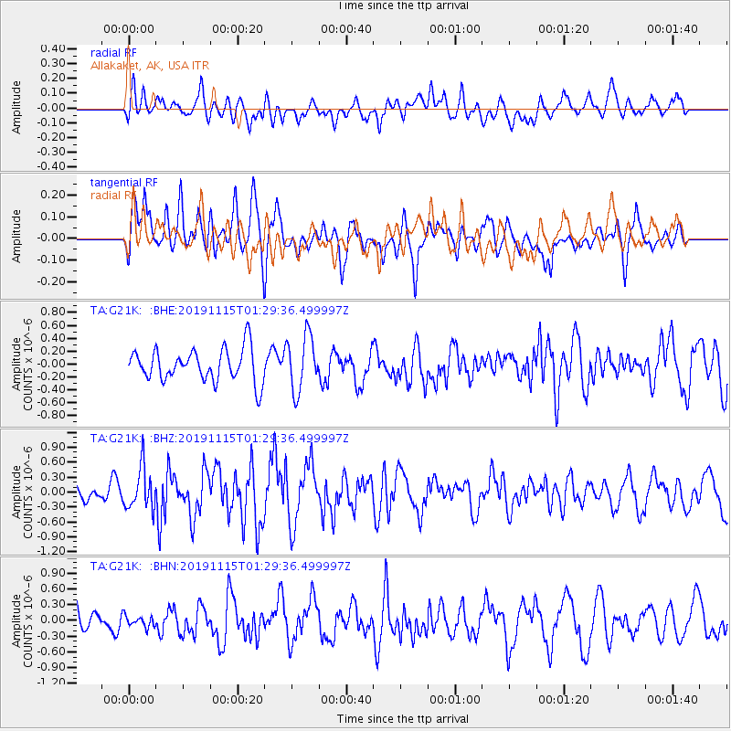
G21K Allakaket, AK, USA - Earthquake Result Viewer
*The percent match for this event was below the threshold and hence no stack was calculated.
| Earthquake location: |
Northern Molucca Sea |
| Earthquake latitude/longitude: |
1.6/126.4 |
| Earthquake time(UTC): |
2019/11/15 (319) 01:17:38 GMT |
| Earthquake Depth: |
44 km |
| Earthquake Magnitude: |
5.9 Mww |
| Earthquake Catalog/Contributor: |
NEIC PDE/us |
|
| Network: |
TA USArray Transportable Network (new EarthScope stations) |
| Station: |
G21K Allakaket, AK, USA |
| Lat/Lon: |
66.52 N/153.51 W |
| Elevation: |
446 m |
|
| Distance: |
84.6 deg |
| Az: |
23.365 deg |
| Baz: |
261.584 deg |
| Ray Param: |
$rayparam |
*The percent match for this event was below the threshold and hence was not used in the summary stack. |
|
| Radial Match: |
50.05692 % |
| Radial Bump: |
400 |
| Transverse Match: |
52.756493 % |
| Transverse Bump: |
400 |
| SOD ConfigId: |
19951751 |
| Insert Time: |
2019-11-29 01:27:04.838 +0000 |
| GWidth: |
2.5 |
| Max Bumps: |
400 |
| Tol: |
0.001 |
|
Signal To Noise
| Channel | StoN | STA | LTA |
| TA:G21K: :BHZ:20191115T01:29:36.499997Z | 3.1005871 | 4.2354162E-7 | 1.3660046E-7 |
| TA:G21K: :BHN:20191115T01:29:36.499997Z | 0.3734531 | 1.01788835E-7 | 2.725612E-7 |
| TA:G21K: :BHE:20191115T01:29:36.499997Z | 1.7025363 | 4.3091705E-7 | 2.53103E-7 |
| Arrivals |
| Ps | |
| PpPs | |
| PsPs/PpSs | |


