You are here: Home > Network List > TA - USArray Transportable Network (new EarthScope stations) Stations List
> Station H31M Peel River, Yukon, CAN > Earthquake Result Viewer
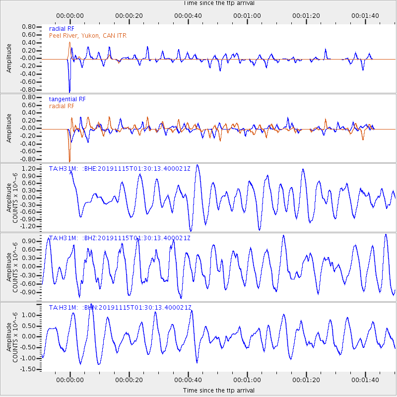
H31M Peel River, Yukon, CAN - Earthquake Result Viewer
*The percent match for this event was below the threshold and hence no stack was calculated.
| Earthquake location: |
Northern Molucca Sea |
| Earthquake latitude/longitude: |
1.6/126.4 |
| Earthquake time(UTC): |
2019/11/15 (319) 01:17:38 GMT |
| Earthquake Depth: |
44 km |
| Earthquake Magnitude: |
5.9 Mww |
| Earthquake Catalog/Contributor: |
NEIC PDE/us |
|
| Network: |
TA USArray Transportable Network (new EarthScope stations) |
| Station: |
H31M Peel River, Yukon, CAN |
| Lat/Lon: |
65.81 N/134.34 W |
| Elevation: |
642 m |
|
| Distance: |
92.4 deg |
| Az: |
24.02 deg |
| Baz: |
279.137 deg |
| Ray Param: |
$rayparam |
*The percent match for this event was below the threshold and hence was not used in the summary stack. |
|
| Radial Match: |
63.93055 % |
| Radial Bump: |
384 |
| Transverse Match: |
68.13695 % |
| Transverse Bump: |
400 |
| SOD ConfigId: |
19951751 |
| Insert Time: |
2019-11-29 01:27:08.689 +0000 |
| GWidth: |
2.5 |
| Max Bumps: |
400 |
| Tol: |
0.001 |
|
Signal To Noise
| Channel | StoN | STA | LTA |
| TA:H31M: :BHZ:20191115T01:30:13.400021Z | 1.2298591 | 5.536096E-7 | 4.5014062E-7 |
| TA:H31M: :BHN:20191115T01:30:13.400021Z | 2.0740669 | 8.102379E-7 | 3.9065176E-7 |
| TA:H31M: :BHE:20191115T01:30:13.400021Z | 0.8691636 | 4.0956496E-7 | 4.7121736E-7 |
| Arrivals |
| Ps | |
| PpPs | |
| PsPs/PpSs | |


