You are here: Home > Network List > AV - Alaska Volcano Observatory Stations List
> Station SPCR Ckakachatna River, Mount Spurr, Alaska > Earthquake Result Viewer
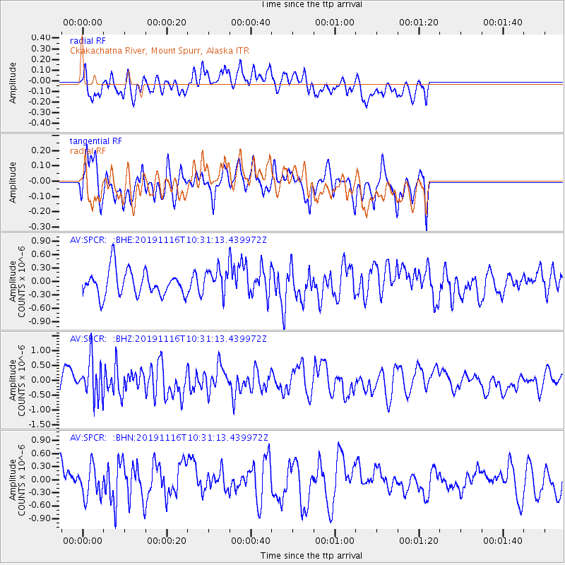
SPCR Ckakachatna River, Mount Spurr, Alaska - Earthquake Result Viewer
*The percent match for this event was below the threshold and hence no stack was calculated.
| Earthquake location: |
Northern Molucca Sea |
| Earthquake latitude/longitude: |
1.5/126.3 |
| Earthquake time(UTC): |
2019/11/16 (320) 10:19:15 GMT |
| Earthquake Depth: |
35 km |
| Earthquake Magnitude: |
5.8 Mww |
| Earthquake Catalog/Contributor: |
NEIC PDE/us |
|
| Network: |
AV Alaska Volcano Observatory |
| Station: |
SPCR Ckakachatna River, Mount Spurr, Alaska |
| Lat/Lon: |
61.20 N/152.21 W |
| Elevation: |
984 m |
|
| Distance: |
84.5 deg |
| Az: |
28.755 deg |
| Baz: |
263.258 deg |
| Ray Param: |
$rayparam |
*The percent match for this event was below the threshold and hence was not used in the summary stack. |
|
| Radial Match: |
57.223106 % |
| Radial Bump: |
400 |
| Transverse Match: |
48.524914 % |
| Transverse Bump: |
400 |
| SOD ConfigId: |
19951751 |
| Insert Time: |
2019-11-30 10:25:14.410 +0000 |
| GWidth: |
2.5 |
| Max Bumps: |
400 |
| Tol: |
0.001 |
|
Signal To Noise
| Channel | StoN | STA | LTA |
| AV:SPCR: :BHZ:20191116T10:31:13.439972Z | 2.5636337 | 6.362811E-7 | 2.48195E-7 |
| AV:SPCR: :BHN:20191116T10:31:13.439972Z | 1.2509742 | 3.5194017E-7 | 2.8133286E-7 |
| AV:SPCR: :BHE:20191116T10:31:13.439972Z | 1.0016484 | 2.8254416E-7 | 2.8207918E-7 |
| Arrivals |
| Ps | |
| PpPs | |
| PsPs/PpSs | |


