You are here: Home > Network List > TA - USArray Transportable Network (new EarthScope stations) Stations List
> Station A22K Sinclair Lake, AK, USA > Earthquake Result Viewer
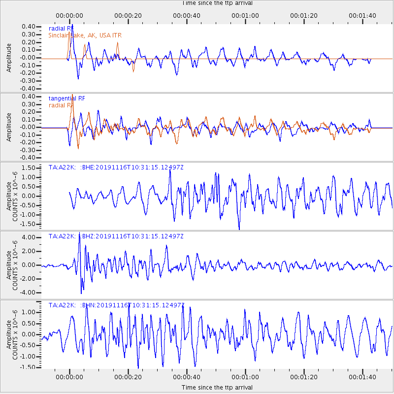
A22K Sinclair Lake, AK, USA - Earthquake Result Viewer
*The percent match for this event was below the threshold and hence no stack was calculated.
| Earthquake location: |
Northern Molucca Sea |
| Earthquake latitude/longitude: |
1.5/126.3 |
| Earthquake time(UTC): |
2019/11/16 (320) 10:19:15 GMT |
| Earthquake Depth: |
35 km |
| Earthquake Magnitude: |
5.8 Mww |
| Earthquake Catalog/Contributor: |
NEIC PDE/us |
|
| Network: |
TA USArray Transportable Network (new EarthScope stations) |
| Station: |
A22K Sinclair Lake, AK, USA |
| Lat/Lon: |
71.00 N/154.97 W |
| Elevation: |
6.0 m |
|
| Distance: |
84.9 deg |
| Az: |
18.809 deg |
| Baz: |
259.801 deg |
| Ray Param: |
$rayparam |
*The percent match for this event was below the threshold and hence was not used in the summary stack. |
|
| Radial Match: |
68.69296 % |
| Radial Bump: |
381 |
| Transverse Match: |
52.645325 % |
| Transverse Bump: |
400 |
| SOD ConfigId: |
19951751 |
| Insert Time: |
2019-11-30 10:26:56.751 +0000 |
| GWidth: |
2.5 |
| Max Bumps: |
400 |
| Tol: |
0.001 |
|
Signal To Noise
| Channel | StoN | STA | LTA |
| TA:A22K: :BHZ:20191116T10:31:15.12497Z | 14.257851 | 1.8585953E-6 | 1.3035591E-7 |
| TA:A22K: :BHN:20191116T10:31:15.12497Z | 1.1423626 | 5.522625E-7 | 4.834389E-7 |
| TA:A22K: :BHE:20191116T10:31:15.12497Z | 1.5836202 | 4.5420845E-7 | 2.8681652E-7 |
| Arrivals |
| Ps | |
| PpPs | |
| PsPs/PpSs | |


