You are here: Home > Network List > TA - USArray Transportable Network (new EarthScope stations) Stations List
> Station F21K Alatna River, AK, USA > Earthquake Result Viewer
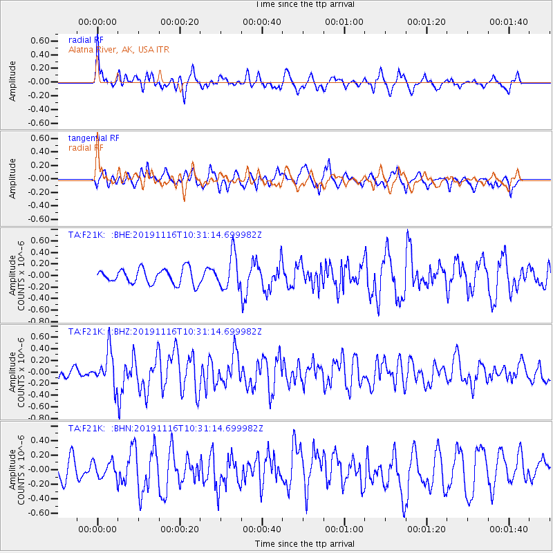
F21K Alatna River, AK, USA - Earthquake Result Viewer
*The percent match for this event was below the threshold and hence no stack was calculated.
| Earthquake location: |
Northern Molucca Sea |
| Earthquake latitude/longitude: |
1.5/126.3 |
| Earthquake time(UTC): |
2019/11/16 (320) 10:19:15 GMT |
| Earthquake Depth: |
35 km |
| Earthquake Magnitude: |
5.8 Mww |
| Earthquake Catalog/Contributor: |
NEIC PDE/us |
|
| Network: |
TA USArray Transportable Network (new EarthScope stations) |
| Station: |
F21K Alatna River, AK, USA |
| Lat/Lon: |
67.22 N/153.48 W |
| Elevation: |
597 m |
|
| Distance: |
84.8 deg |
| Az: |
22.661 deg |
| Baz: |
261.542 deg |
| Ray Param: |
$rayparam |
*The percent match for this event was below the threshold and hence was not used in the summary stack. |
|
| Radial Match: |
54.49459 % |
| Radial Bump: |
400 |
| Transverse Match: |
56.781334 % |
| Transverse Bump: |
400 |
| SOD ConfigId: |
19951751 |
| Insert Time: |
2019-11-30 10:27:14.497 +0000 |
| GWidth: |
2.5 |
| Max Bumps: |
400 |
| Tol: |
0.001 |
|
Signal To Noise
| Channel | StoN | STA | LTA |
| TA:F21K: :BHZ:20191116T10:31:14.699982Z | 2.2836838 | 3.091953E-7 | 1.3539322E-7 |
| TA:F21K: :BHN:20191116T10:31:14.699982Z | 0.7879653 | 1.0756002E-7 | 1.3650349E-7 |
| TA:F21K: :BHE:20191116T10:31:14.699982Z | 2.3637943 | 3.045637E-7 | 1.2884527E-7 |
| Arrivals |
| Ps | |
| PpPs | |
| PsPs/PpSs | |


