You are here: Home > Network List > TA - USArray Transportable Network (new EarthScope stations) Stations List
> Station I17K Unalakleet, AK, USA > Earthquake Result Viewer
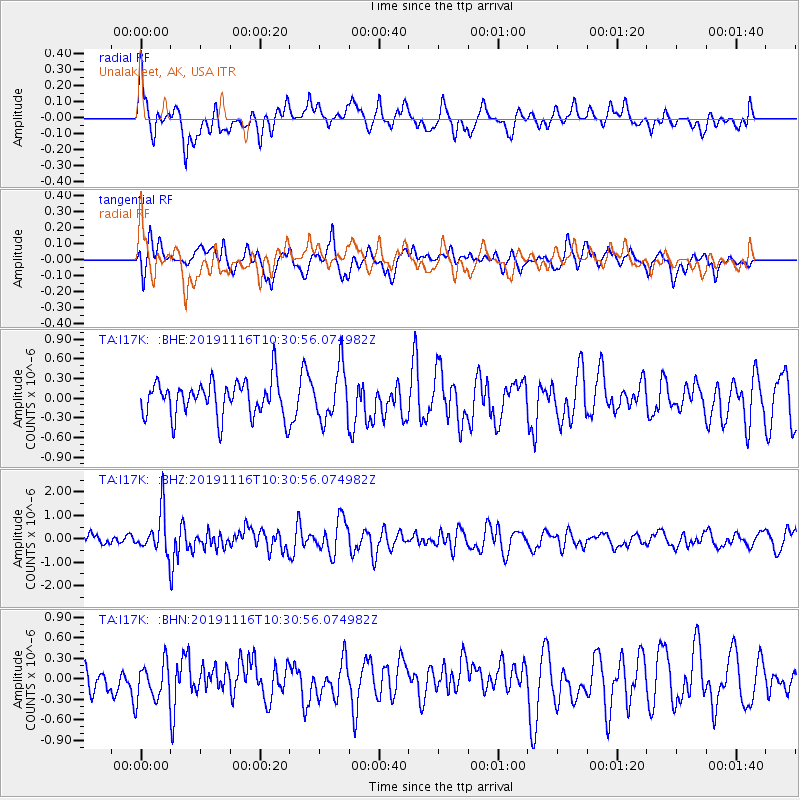
I17K Unalakleet, AK, USA - Earthquake Result Viewer
*The percent match for this event was below the threshold and hence no stack was calculated.
| Earthquake location: |
Northern Molucca Sea |
| Earthquake latitude/longitude: |
1.5/126.3 |
| Earthquake time(UTC): |
2019/11/16 (320) 10:19:15 GMT |
| Earthquake Depth: |
35 km |
| Earthquake Magnitude: |
5.8 Mww |
| Earthquake Catalog/Contributor: |
NEIC PDE/us |
|
| Network: |
TA USArray Transportable Network (new EarthScope stations) |
| Station: |
I17K Unalakleet, AK, USA |
| Lat/Lon: |
63.89 N/160.70 W |
| Elevation: |
105 m |
|
| Distance: |
81.2 deg |
| Az: |
25.355 deg |
| Baz: |
255.31 deg |
| Ray Param: |
$rayparam |
*The percent match for this event was below the threshold and hence was not used in the summary stack. |
|
| Radial Match: |
62.76478 % |
| Radial Bump: |
400 |
| Transverse Match: |
68.083275 % |
| Transverse Bump: |
400 |
| SOD ConfigId: |
19951751 |
| Insert Time: |
2019-11-30 10:27:25.011 +0000 |
| GWidth: |
2.5 |
| Max Bumps: |
400 |
| Tol: |
0.001 |
|
Signal To Noise
| Channel | StoN | STA | LTA |
| TA:I17K: :BHZ:20191116T10:30:56.074982Z | 3.6129887 | 8.9296265E-7 | 2.4715345E-7 |
| TA:I17K: :BHN:20191116T10:30:56.074982Z | 1.3778508 | 2.7361622E-7 | 1.9858189E-7 |
| TA:I17K: :BHE:20191116T10:30:56.074982Z | 1.4544551 | 3.9398242E-7 | 2.7087975E-7 |
| Arrivals |
| Ps | |
| PpPs | |
| PsPs/PpSs | |


