You are here: Home > Network List > TA - USArray Transportable Network (new EarthScope stations) Stations List
> Station L15K Ungalak Mountain, AK, USA > Earthquake Result Viewer
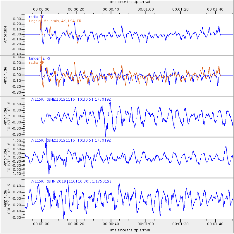
L15K Ungalak Mountain, AK, USA - Earthquake Result Viewer
*The percent match for this event was below the threshold and hence no stack was calculated.
| Earthquake location: |
Northern Molucca Sea |
| Earthquake latitude/longitude: |
1.5/126.3 |
| Earthquake time(UTC): |
2019/11/16 (320) 10:19:15 GMT |
| Earthquake Depth: |
35 km |
| Earthquake Magnitude: |
5.8 Mww |
| Earthquake Catalog/Contributor: |
NEIC PDE/us |
|
| Network: |
TA USArray Transportable Network (new EarthScope stations) |
| Station: |
L15K Ungalak Mountain, AK, USA |
| Lat/Lon: |
61.68 N/161.49 W |
| Elevation: |
219 m |
|
| Distance: |
80.2 deg |
| Az: |
27.432 deg |
| Baz: |
254.942 deg |
| Ray Param: |
$rayparam |
*The percent match for this event was below the threshold and hence was not used in the summary stack. |
|
| Radial Match: |
54.04926 % |
| Radial Bump: |
400 |
| Transverse Match: |
68.13579 % |
| Transverse Bump: |
400 |
| SOD ConfigId: |
19951751 |
| Insert Time: |
2019-11-30 10:27:30.204 +0000 |
| GWidth: |
2.5 |
| Max Bumps: |
400 |
| Tol: |
0.001 |
|
Signal To Noise
| Channel | StoN | STA | LTA |
| TA:L15K: :BHZ:20191116T10:30:51.175019Z | 2.352735 | 6.087864E-7 | 2.587569E-7 |
| TA:L15K: :BHN:20191116T10:30:51.175019Z | 0.98820573 | 2.6188934E-7 | 2.65015E-7 |
| TA:L15K: :BHE:20191116T10:30:51.175019Z | 1.6086166 | 2.7917227E-7 | 1.7354806E-7 |
| Arrivals |
| Ps | |
| PpPs | |
| PsPs/PpSs | |


