You are here: Home > Network List > GS - US Geological Survey Networks Stations List
> Station KAN08 Pence Farm, Harper, KS, USA > Earthquake Result Viewer
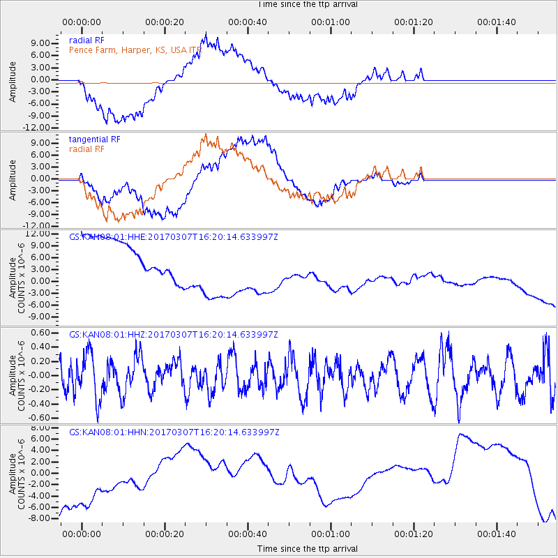
KAN08 Pence Farm, Harper, KS, USA - Earthquake Result Viewer
*The percent match for this event was below the threshold and hence no stack was calculated.
| Earthquake location: |
Hokkaido, Japan Region |
| Earthquake latitude/longitude: |
41.5/141.9 |
| Earthquake time(UTC): |
2017/03/07 (066) 16:08:18 GMT |
| Earthquake Depth: |
50 km |
| Earthquake Magnitude: |
5.7 Mww |
| Earthquake Catalog/Contributor: |
NEIC PDE/us |
|
| Network: |
GS US Geological Survey Networks |
| Station: |
KAN08 Pence Farm, Harper, KS, USA |
| Lat/Lon: |
37.23 N/97.97 W |
| Elevation: |
375 m |
|
| Distance: |
84.4 deg |
| Az: |
43.917 deg |
| Baz: |
319.282 deg |
| Ray Param: |
$rayparam |
*The percent match for this event was below the threshold and hence was not used in the summary stack. |
|
| Radial Match: |
51.415257 % |
| Radial Bump: |
400 |
| Transverse Match: |
40.92656 % |
| Transverse Bump: |
400 |
| SOD ConfigId: |
1992691 |
| Insert Time: |
2017-03-21 16:09:31.903 +0000 |
| GWidth: |
2.5 |
| Max Bumps: |
400 |
| Tol: |
0.001 |
|
Signal To Noise
| Channel | StoN | STA | LTA |
| GS:KAN08:01:HHZ:20170307T16:20:14.633997Z | 1.4535638 | 3.3383145E-7 | 2.2966414E-7 |
| GS:KAN08:01:HHN:20170307T16:20:14.633997Z | 1.0963923 | 1.0117143E-5 | 9.227668E-6 |
| GS:KAN08:01:HHE:20170307T16:20:14.633997Z | 2.354826 | 1.0580184E-5 | 4.492979E-6 |
| Arrivals |
| Ps | |
| PpPs | |
| PsPs/PpSs | |


