You are here: Home > Network List > GS - US Geological Survey Networks Stations List
> Station OK031 2598 S. Brethren Rd., Cushing, OK, USA > Earthquake Result Viewer
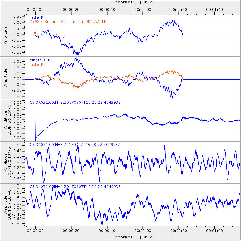
OK031 2598 S. Brethren Rd., Cushing, OK, USA - Earthquake Result Viewer
*The percent match for this event was below the threshold and hence no stack was calculated.
| Earthquake location: |
Hokkaido, Japan Region |
| Earthquake latitude/longitude: |
41.5/141.9 |
| Earthquake time(UTC): |
2017/03/07 (066) 16:08:18 GMT |
| Earthquake Depth: |
50 km |
| Earthquake Magnitude: |
5.7 Mww |
| Earthquake Catalog/Contributor: |
NEIC PDE/us |
|
| Network: |
GS US Geological Survey Networks |
| Station: |
OK031 2598 S. Brethren Rd., Cushing, OK, USA |
| Lat/Lon: |
35.95 N/96.84 W |
| Elevation: |
290 m |
|
| Distance: |
86.0 deg |
| Az: |
44.047 deg |
| Baz: |
319.964 deg |
| Ray Param: |
$rayparam |
*The percent match for this event was below the threshold and hence was not used in the summary stack. |
|
| Radial Match: |
37.58697 % |
| Radial Bump: |
400 |
| Transverse Match: |
32.482937 % |
| Transverse Bump: |
400 |
| SOD ConfigId: |
1992691 |
| Insert Time: |
2017-03-21 16:09:44.038 +0000 |
| GWidth: |
2.5 |
| Max Bumps: |
400 |
| Tol: |
0.001 |
|
Signal To Noise
| Channel | StoN | STA | LTA |
| GS:OK031:00:HHZ:20170307T16:20:22.404993Z | 1.9401044 | 3.6380135E-7 | 1.8751638E-7 |
| GS:OK031:00:HH1:20170307T16:20:22.404993Z | 0.9660797 | 9.888377E-7 | 1.0235569E-6 |
| GS:OK031:00:HH2:20170307T16:20:22.404993Z | 1.0641242 | 2.6634598E-6 | 2.5029594E-6 |
| Arrivals |
| Ps | |
| PpPs | |
| PsPs/PpSs | |


