W15A Williams, AZ, USA - Earthquake Result Viewer
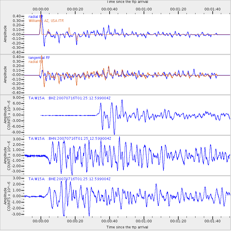
Earthquake location: Near West Coast Of Honshu, Japan
Earthquake latitude/longitude: 37.5/138.4
Earthquake time(UTC): 2007/07/16 (197) 01:13:22 GMT
Earthquake Depth: 12 km
Earthquake Magnitude: 6.5 MB, 6.4 MS, 6.6 MW, 6.5 MW
Earthquake Catalog/Contributor: WHDF/NEIC
Network: TA USArray Transportable Network (new EarthScope stations)
Station: W15A Williams, AZ, USA
Lat/Lon: 35.18 N/112.27 W
Elevation: 2034 m
Distance: 82.4 deg
Az: 51.271 deg
Baz: 310.796 deg
Ray Param: 0.046934046
Estimated Moho Depth: 34.0 km
Estimated Crust Vp/Vs: 1.97
Assumed Crust Vp: 6.276 km/s
Estimated Crust Vs: 3.194 km/s
Estimated Crust Poisson's Ratio: 0.33
Radial Match: 96.312256 %
Radial Bump: 400
Transverse Match: 93.19335 %
Transverse Bump: 400
SOD ConfigId: 2564
Insert Time: 2010-03-07 05:55:47.303 +0000
GWidth: 2.5
Max Bumps: 400
Tol: 0.001

Signal To Noise

ChannelStoNSTALTA
TA:W15A: :BHN:20070716T01:25:12.599004Z3.38166122.885503E-78.5327976E-8
TA:W15A: :BHE:20070716T01:25:12.599004Z4.8135154.1187442E-78.556624E-8
TA:W15A: :BHZ:20070716T01:25:12.599004Z37.9848481.6102243E-64.239123E-8
Arrivals
Ps5.3 SECOND
PpPs16 SECOND
PsPs/PpSs21 SECOND