You are here: Home > Network List > TA - USArray Transportable Network (new EarthScope stations) Stations List
> Station D25K Kavik River, AK, USA > Earthquake Result Viewer
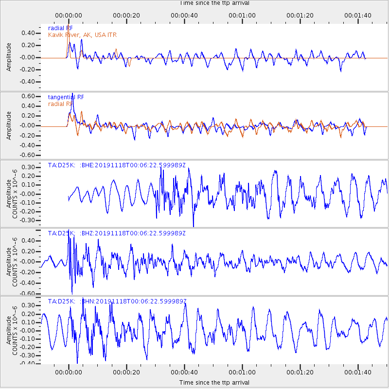
D25K Kavik River, AK, USA - Earthquake Result Viewer
*The percent match for this event was below the threshold and hence no stack was calculated.
| Earthquake location: |
Mariana Islands |
| Earthquake latitude/longitude: |
13.4/145.2 |
| Earthquake time(UTC): |
2019/11/17 (321) 23:55:49 GMT |
| Earthquake Depth: |
68 km |
| Earthquake Magnitude: |
5.6 mb |
| Earthquake Catalog/Contributor: |
NEIC PDE/us |
|
| Network: |
TA USArray Transportable Network (new EarthScope stations) |
| Station: |
D25K Kavik River, AK, USA |
| Lat/Lon: |
69.32 N/146.38 W |
| Elevation: |
770 m |
|
| Distance: |
69.9 deg |
| Az: |
20.586 deg |
| Baz: |
254.397 deg |
| Ray Param: |
$rayparam |
*The percent match for this event was below the threshold and hence was not used in the summary stack. |
|
| Radial Match: |
66.78771 % |
| Radial Bump: |
400 |
| Transverse Match: |
59.847355 % |
| Transverse Bump: |
400 |
| SOD ConfigId: |
19951751 |
| Insert Time: |
2019-12-02 00:08:29.343 +0000 |
| GWidth: |
2.5 |
| Max Bumps: |
400 |
| Tol: |
0.001 |
|
Signal To Noise
| Channel | StoN | STA | LTA |
| TA:D25K: :BHZ:20191118T00:06:22.599989Z | 2.7128308 | 2.6860573E-7 | 9.901308E-8 |
| TA:D25K: :BHN:20191118T00:06:22.599989Z | 1.2923259 | 1.6968822E-7 | 1.3130452E-7 |
| TA:D25K: :BHE:20191118T00:06:22.599989Z | 1.3652587 | 1.1859405E-7 | 8.6865626E-8 |
| Arrivals |
| Ps | |
| PpPs | |
| PsPs/PpSs | |


