You are here: Home > Network List > US - United States National Seismic Network Stations List
> Station HAWA Hanford, Washington, USA > Earthquake Result Viewer
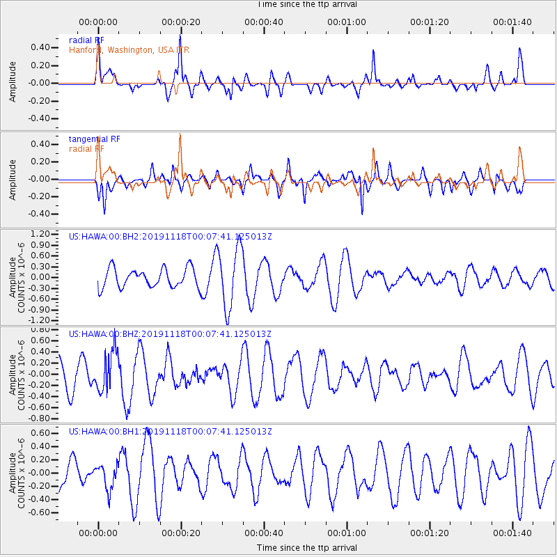
HAWA Hanford, Washington, USA - Earthquake Result Viewer
*The percent match for this event was below the threshold and hence no stack was calculated.
| Earthquake location: |
Mariana Islands |
| Earthquake latitude/longitude: |
13.4/145.2 |
| Earthquake time(UTC): |
2019/11/17 (321) 23:55:49 GMT |
| Earthquake Depth: |
68 km |
| Earthquake Magnitude: |
5.6 mb |
| Earthquake Catalog/Contributor: |
NEIC PDE/us |
|
| Network: |
US United States National Seismic Network |
| Station: |
HAWA Hanford, Washington, USA |
| Lat/Lon: |
46.39 N/119.53 W |
| Elevation: |
364 m |
|
| Distance: |
84.0 deg |
| Az: |
43.873 deg |
| Baz: |
283.025 deg |
| Ray Param: |
$rayparam |
*The percent match for this event was below the threshold and hence was not used in the summary stack. |
|
| Radial Match: |
59.60175 % |
| Radial Bump: |
400 |
| Transverse Match: |
70.45765 % |
| Transverse Bump: |
400 |
| SOD ConfigId: |
19951751 |
| Insert Time: |
2019-12-02 00:09:17.310 +0000 |
| GWidth: |
2.5 |
| Max Bumps: |
400 |
| Tol: |
0.001 |
|
Signal To Noise
| Channel | StoN | STA | LTA |
| US:HAWA:00:BHZ:20191118T00:07:41.125013Z | 1.0425706 | 3.670658E-7 | 3.5207765E-7 |
| US:HAWA:00:BH1:20191118T00:07:41.125013Z | 0.90619683 | 1.8845827E-7 | 2.0796615E-7 |
| US:HAWA:00:BH2:20191118T00:07:41.125013Z | 3.2330346 | 8.53292E-7 | 2.6392914E-7 |
| Arrivals |
| Ps | |
| PpPs | |
| PsPs/PpSs | |


