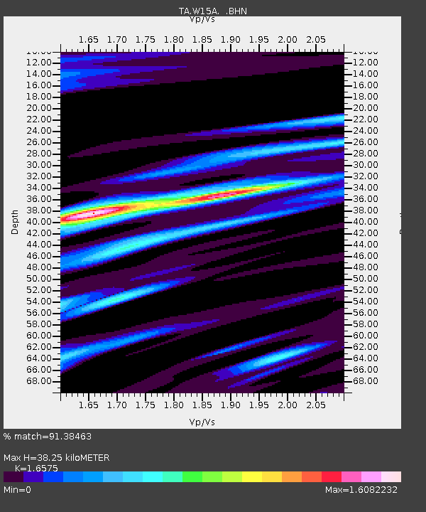
W15A Williams, AZ, USA - Earthquake Result Viewer
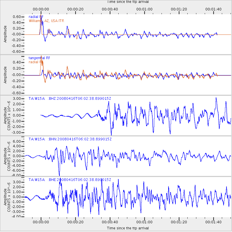
Earthquake location: Andreanof Islands, Aleutian Is.
Earthquake latitude/longitude: 51.9/-179.2
Earthquake time(UTC): 2008/04/16 (107) 05:54:19 GMT
Earthquake Depth: 13 km
Earthquake Magnitude: 6.1 MB, 6.5 MS, 6.6 MW, 6.6 MW
Earthquake Catalog/Contributor: WHDF/NEIC
Network: TA USArray Transportable Network (new EarthScope stations)
Station: W15A Williams, AZ, USA
Lat/Lon: 35.18 N/112.27 W
Elevation: 2034 m
Distance: 49.5 deg
Az: 82.191 deg
Baz: 311.434 deg
Ray Param: 0.06864604
Estimated Moho Depth: 38.25 km
Estimated Crust Vp/Vs: 1.66
Assumed Crust Vp: 6.276 km/s
Estimated Crust Vs: 3.786 km/s
Estimated Crust Poisson's Ratio: 0.21
Radial Match: 91.38463 %
Radial Bump: 400
Transverse Match: 78.6521 %
Transverse Bump: 400
SOD ConfigId: 2504
Insert Time: 2010-03-07 05:57:11.338 +0000
GWidth: 2.5
Max Bumps: 400
Tol: 0.001

Signal To Noise

ChannelStoNSTALTA
TA:W15A: :BHN:20080416T06:02:38.899015Z3.50357038.085852E-72.3078891E-7
TA:W15A: :BHE:20080416T06:02:38.899015Z1.13298732.9831438E-72.6329897E-7
TA:W15A: :BHZ:20080416T06:02:38.899015Z1.99312043.282541E-71.6469356E-7
Arrivals
Ps4.3 SECOND
PpPs15 SECOND
PsPs/PpSs20 SECOND