You are here: Home > Network List > TA - USArray Transportable Network (new EarthScope stations) Stations List
> Station W15A Williams, AZ, USA > Earthquake Result Viewer
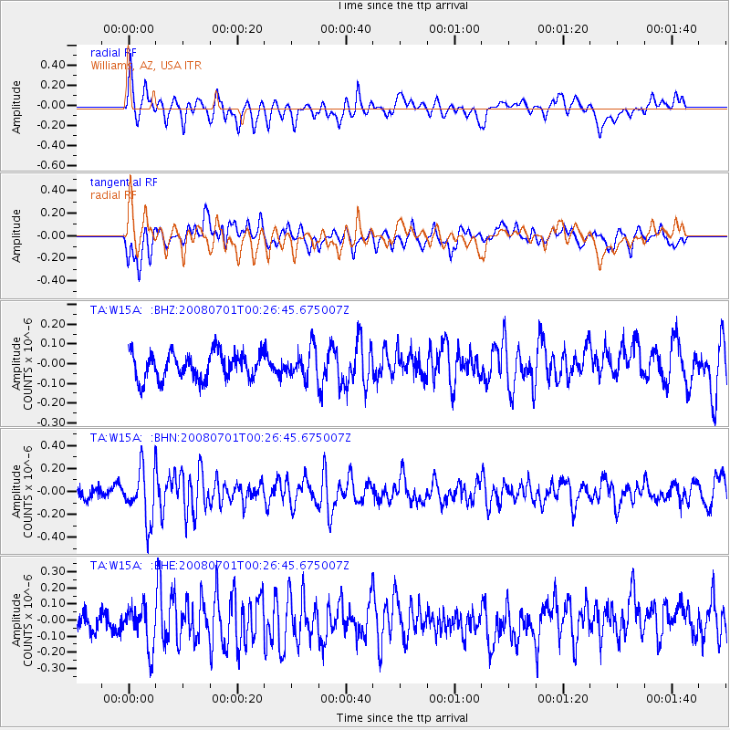
W15A Williams, AZ, USA - Earthquake Result Viewer
*The percent match for this event was below the threshold and hence no stack was calculated.
| Earthquake location: |
Central Peru |
| Earthquake latitude/longitude: |
-10.4/-75.5 |
| Earthquake time(UTC): |
2008/07/01 (183) 00:17:33 GMT |
| Earthquake Depth: |
33 km |
| Earthquake Magnitude: |
5.5 MW, 5.0 MS, 5.4 MB, 5.3 ML |
| Earthquake Catalog/Contributor: |
WHDF/NEIC |
|
| Network: |
TA USArray Transportable Network (new EarthScope stations) |
| Station: |
W15A Williams, AZ, USA |
| Lat/Lon: |
35.18 N/112.27 W |
| Elevation: |
2034 m |
|
| Distance: |
57.1 deg |
| Az: |
324.28 deg |
| Baz: |
135.475 deg |
| Ray Param: |
$rayparam |
*The percent match for this event was below the threshold and hence was not used in the summary stack. |
|
| Radial Match: |
66.31566 % |
| Radial Bump: |
400 |
| Transverse Match: |
68.45146 % |
| Transverse Bump: |
400 |
| SOD ConfigId: |
2504 |
| Insert Time: |
2010-03-07 05:57:37.798 +0000 |
| GWidth: |
2.5 |
| Max Bumps: |
400 |
| Tol: |
0.001 |
|
Signal To Noise
| Channel | StoN | STA | LTA |
| TA:W15A: :BHN:20080701T00:26:45.675007Z | 4.1527376 | 2.306525E-7 | 5.5542273E-8 |
| TA:W15A: :BHE:20080701T00:26:45.675007Z | 1.7250377 | 1.3660544E-7 | 7.9189824E-8 |
| TA:W15A: :BHZ:20080701T00:26:45.675007Z | 1.1194714 | 7.517301E-8 | 6.715045E-8 |
| Arrivals |
| Ps | |
| PpPs | |
| PsPs/PpSs | |


