You are here: Home > Network List > TA - USArray Transportable Network (new EarthScope stations) Stations List
> Station W15A Williams, AZ, USA > Earthquake Result Viewer
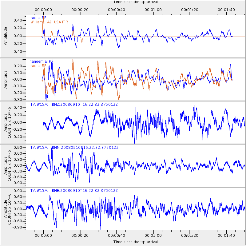
W15A Williams, AZ, USA - Earthquake Result Viewer
*The percent match for this event was below the threshold and hence no stack was calculated.
| Earthquake location: |
Northern Chile |
| Earthquake latitude/longitude: |
-20.3/-69.2 |
| Earthquake time(UTC): |
2008/09/10 (254) 16:12:04 GMT |
| Earthquake Depth: |
38 km |
| Earthquake Magnitude: |
5.6 MB, 5.3 MS |
| Earthquake Catalog/Contributor: |
WHDF/NEIC |
|
| Network: |
TA USArray Transportable Network (new EarthScope stations) |
| Station: |
W15A Williams, AZ, USA |
| Lat/Lon: |
35.18 N/112.27 W |
| Elevation: |
2034 m |
|
| Distance: |
68.6 deg |
| Az: |
323.097 deg |
| Baz: |
136.512 deg |
| Ray Param: |
$rayparam |
*The percent match for this event was below the threshold and hence was not used in the summary stack. |
|
| Radial Match: |
59.118084 % |
| Radial Bump: |
400 |
| Transverse Match: |
59.57403 % |
| Transverse Bump: |
400 |
| SOD ConfigId: |
2504 |
| Insert Time: |
2010-03-07 05:58:14.778 +0000 |
| GWidth: |
2.5 |
| Max Bumps: |
400 |
| Tol: |
0.001 |
|
Signal To Noise
| Channel | StoN | STA | LTA |
| TA:W15A: :BHN:20080910T16:22:32.375012Z | 2.165834 | 3.3209474E-7 | 1.5333343E-7 |
| TA:W15A: :BHE:20080910T16:22:32.375012Z | 2.6501682 | 3.1979218E-7 | 1.2066863E-7 |
| TA:W15A: :BHZ:20080910T16:22:32.375012Z | 1.8110201 | 2.0498267E-7 | 1.131863E-7 |
| Arrivals |
| Ps | |
| PpPs | |
| PsPs/PpSs | |


