You are here: Home > Network List > TA - USArray Transportable Network (new EarthScope stations) Stations List
> Station P11A Cicrle Ranch, Eureka, NV, USA > Earthquake Result Viewer
P11A Cicrle Ranch, Eureka, NV, USA - Earthquake Result Viewer
| Earthquake location: |
Near Coast Of Peru |
| Earthquake latitude/longitude: |
-13.3/-76.5 |
| Earthquake time(UTC): |
2007/08/16 (228) 00:02:41 GMT |
| Earthquake Depth: |
40 km |
| Earthquake Magnitude: |
5.6 MB |
| Earthquake Catalog/Contributor: |
WHDF/NEIC |
|
| Network: |
TA USArray Transportable Network (new EarthScope stations) |
| Station: |
P11A Cicrle Ranch, Eureka, NV, USA |
| Lat/Lon: |
39.55 N/115.75 W |
| Elevation: |
1787 m |
|
| Distance: |
64.0 deg |
| Az: |
327.016 deg |
| Baz: |
136.714 deg |
| Ray Param: |
0.05913241 |
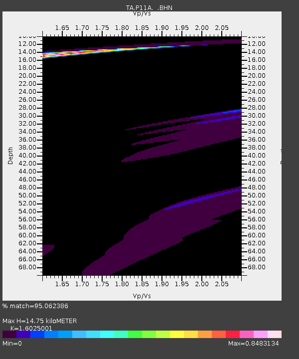
| Estimated Moho Depth: |
14.75 km |
| Estimated Crust Vp/Vs: |
1.60 |
| Assumed Crust Vp: |
6.276 km/s |
| Estimated Crust Vs: |
3.916 km/s |
| Estimated Crust Poisson's Ratio: |
0.18 |
|
| Radial Match: |
95.062386 % |
| Radial Bump: |
308 |
| Transverse Match: |
35.027214 % |
| Transverse Bump: |
362 |
| SOD ConfigId: |
2564 |
| Insert Time: |
2010-03-07 05:58:23.561 +0000 |
| GWidth: |
2.5 |
| Max Bumps: |
400 |
| Tol: |
0.001 |
|
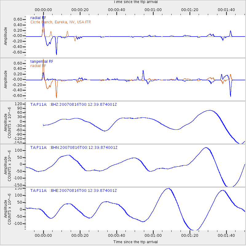
Signal To Noise
| Channel | StoN | STA | LTA |
| TA:P11A: :BHN:20070816T00:12:39.874001Z | 1.1640018 | 3.0280493E-5 | 2.601413E-5 |
| TA:P11A: :BHE:20070816T00:12:39.874001Z | 1.2563169 | 4.3222237E-5 | 3.440393E-5 |
| TA:P11A: :BHZ:20070816T00:12:39.874001Z | 3.7455149 | 6.00715E-5 | 1.603825E-5 |
| Arrivals |
| Ps | 1.5 SECOND |
| PpPs | 5.8 SECOND |
| PsPs/PpSs | 7.3 SECOND |


