You are here: Home > Network List > GS - US Geological Survey Networks Stations List
> Station KAN08 Pence Farm, Harper, KS, USA > Earthquake Result Viewer
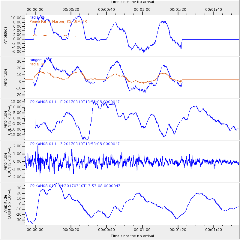
KAN08 Pence Farm, Harper, KS, USA - Earthquake Result Viewer
*The percent match for this event was below the threshold and hence no stack was calculated.
| Earthquake location: |
Near Coast Of Venezuela |
| Earthquake latitude/longitude: |
12.0/-69.6 |
| Earthquake time(UTC): |
2017/03/10 (069) 13:46:39 GMT |
| Earthquake Depth: |
10 km |
| Earthquake Magnitude: |
5.5 mb |
| Earthquake Catalog/Contributor: |
NEIC PDE/us |
|
| Network: |
GS US Geological Survey Networks |
| Station: |
KAN08 Pence Farm, Harper, KS, USA |
| Lat/Lon: |
37.23 N/97.97 W |
| Elevation: |
375 m |
|
| Distance: |
35.8 deg |
| Az: |
319.544 deg |
| Baz: |
127.297 deg |
| Ray Param: |
$rayparam |
*The percent match for this event was below the threshold and hence was not used in the summary stack. |
|
| Radial Match: |
36.64615 % |
| Radial Bump: |
400 |
| Transverse Match: |
55.461235 % |
| Transverse Bump: |
400 |
| SOD ConfigId: |
1992691 |
| Insert Time: |
2017-03-24 13:50:30.524 +0000 |
| GWidth: |
2.5 |
| Max Bumps: |
400 |
| Tol: |
0.001 |
|
Signal To Noise
| Channel | StoN | STA | LTA |
| GS:KAN08:01:HHZ:20170310T13:53:08.000004Z | 1.8076642 | 7.8816703E-7 | 4.360141E-7 |
| GS:KAN08:01:HHN:20170310T13:53:08.000004Z | 1.1690181 | 3.1869324E-5 | 2.7261614E-5 |
| GS:KAN08:01:HHE:20170310T13:53:08.000004Z | 2.8569424 | 1.4130479E-5 | 4.9460145E-6 |
| Arrivals |
| Ps | |
| PpPs | |
| PsPs/PpSs | |


