You are here: Home > Network List > TA - USArray Transportable Network (new EarthScope stations) Stations List
> Station P11A Cicrle Ranch, Eureka, NV, USA > Earthquake Result Viewer
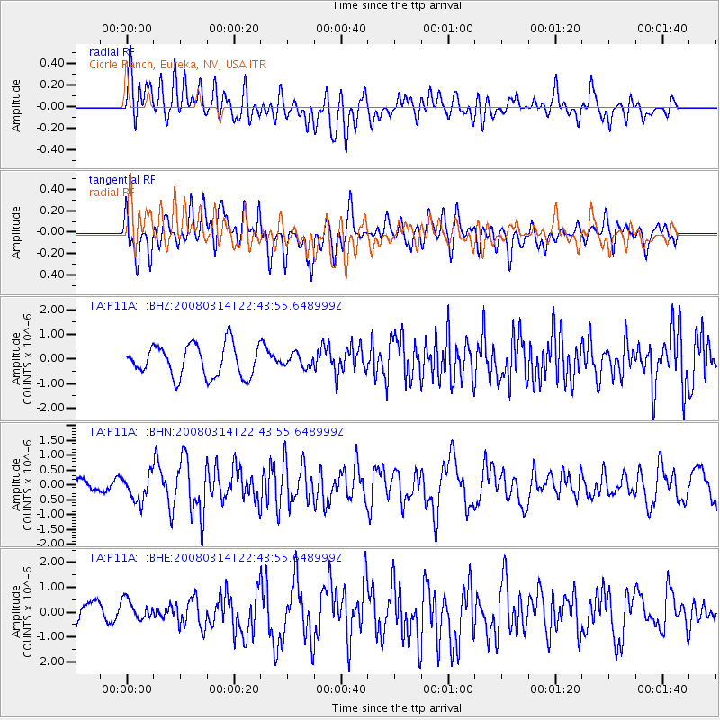
P11A Cicrle Ranch, Eureka, NV, USA - Earthquake Result Viewer
*The percent match for this event was below the threshold and hence no stack was calculated.
| Earthquake location: |
Bonin Islands, Japan Region |
| Earthquake latitude/longitude: |
27.0/142.6 |
| Earthquake time(UTC): |
2008/03/14 (074) 22:32:09 GMT |
| Earthquake Depth: |
11 km |
| Earthquake Magnitude: |
5.7 MB, 5.9 MS, 6.0 MW, 6.0 MW |
| Earthquake Catalog/Contributor: |
WHDF/NEIC |
|
| Network: |
TA USArray Transportable Network (new EarthScope stations) |
| Station: |
P11A Cicrle Ranch, Eureka, NV, USA |
| Lat/Lon: |
39.55 N/115.75 W |
| Elevation: |
1787 m |
|
| Distance: |
81.5 deg |
| Az: |
49.954 deg |
| Baz: |
297.926 deg |
| Ray Param: |
$rayparam |
*The percent match for this event was below the threshold and hence was not used in the summary stack. |
|
| Radial Match: |
66.442474 % |
| Radial Bump: |
400 |
| Transverse Match: |
64.89922 % |
| Transverse Bump: |
400 |
| SOD ConfigId: |
2504 |
| Insert Time: |
2010-03-07 05:59:59.026 +0000 |
| GWidth: |
2.5 |
| Max Bumps: |
400 |
| Tol: |
0.001 |
|
Signal To Noise
| Channel | StoN | STA | LTA |
| TA:P11A: :BHN:20080314T22:43:55.648999Z | 2.1805806 | 4.4341107E-7 | 2.0334541E-7 |
| TA:P11A: :BHE:20080314T22:43:55.648999Z | 0.98380595 | 4.1147345E-7 | 4.1824657E-7 |
| TA:P11A: :BHZ:20080314T22:43:55.648999Z | 0.403698 | 2.5764263E-7 | 6.3820636E-7 |
| Arrivals |
| Ps | |
| PpPs | |
| PsPs/PpSs | |


