You are here: Home > Network List > UU - University of Utah Regional Network Stations List
> Station FORU South Mineral Mountains, UT, USA > Earthquake Result Viewer
FORU South Mineral Mountains, UT, USA - Earthquake Result Viewer
*The percent match for this event was below the threshold and hence no stack was calculated.
| Earthquake location: |
Near Coast Of Venezuela |
| Earthquake latitude/longitude: |
12.0/-69.6 |
| Earthquake time(UTC): |
2017/03/10 (069) 13:46:39 GMT |
| Earthquake Depth: |
10 km |
| Earthquake Magnitude: |
5.5 mb |
| Earthquake Catalog/Contributor: |
NEIC PDE/us |
|
| Network: |
UU University of Utah Regional Network |
| Station: |
FORU South Mineral Mountains, UT, USA |
| Lat/Lon: |
38.46 N/112.86 W |
| Elevation: |
1840 m |
|
| Distance: |
46.6 deg |
| Az: |
312.228 deg |
| Baz: |
112.635 deg |
| Ray Param: |
$rayparam |
*The percent match for this event was below the threshold and hence was not used in the summary stack. |
|
| Radial Match: |
76.47789 % |
| Radial Bump: |
400 |
| Transverse Match: |
52.606163 % |
| Transverse Bump: |
400 |
| SOD ConfigId: |
1992691 |
| Insert Time: |
2017-03-24 13:53:47.037 +0000 |
| GWidth: |
2.5 |
| Max Bumps: |
400 |
| Tol: |
0.001 |
|
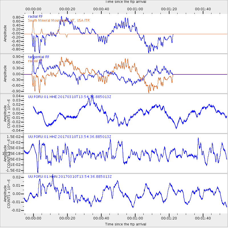
Signal To Noise
| Channel | StoN | STA | LTA |
| UU:FORU:01:HHZ:20170310T13:54:36.885013Z | 2.3378246 | 7.6676E-9 | 3.2798013E-9 |
| UU:FORU:01:HHN:20170310T13:54:36.885013Z | 1.1437111 | 8.386528E-9 | 7.3327326E-9 |
| UU:FORU:01:HHE:20170310T13:54:36.885013Z | 3.156539 | 3.3709416E-8 | 1.0679233E-8 |
| Arrivals |
| Ps | |
| PpPs | |
| PsPs/PpSs | |


