You are here: Home > Network List > TX - Texas Seismological Network Stations List
> Station WTFS Witchita Falls > Earthquake Result Viewer
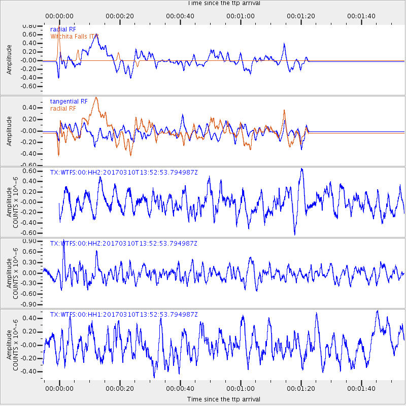
WTFS Witchita Falls - Earthquake Result Viewer
*The percent match for this event was below the threshold and hence no stack was calculated.
| Earthquake location: |
Near Coast Of Venezuela |
| Earthquake latitude/longitude: |
12.0/-69.6 |
| Earthquake time(UTC): |
2017/03/10 (069) 13:46:39 GMT |
| Earthquake Depth: |
10 km |
| Earthquake Magnitude: |
5.5 mb |
| Earthquake Catalog/Contributor: |
NEIC PDE/us |
|
| Network: |
TX Texas Seismological Network |
| Station: |
WTFS Witchita Falls |
| Lat/Lon: |
33.77 N/98.46 W |
| Elevation: |
277 m |
|
| Distance: |
34.1 deg |
| Az: |
314.201 deg |
| Baz: |
122.632 deg |
| Ray Param: |
$rayparam |
*The percent match for this event was below the threshold and hence was not used in the summary stack. |
|
| Radial Match: |
47.150463 % |
| Radial Bump: |
400 |
| Transverse Match: |
43.30951 % |
| Transverse Bump: |
400 |
| SOD ConfigId: |
1992691 |
| Insert Time: |
2017-03-24 13:54:50.671 +0000 |
| GWidth: |
2.5 |
| Max Bumps: |
400 |
| Tol: |
0.001 |
|
Signal To Noise
| Channel | StoN | STA | LTA |
| TX:WTFS:00:HHZ:20170310T13:52:53.794987Z | 3.1181786 | 3.041124E-7 | 9.752886E-8 |
| TX:WTFS:00:HH1:20170310T13:52:53.794987Z | 1.2925104 | 2.1055268E-7 | 1.6290213E-7 |
| TX:WTFS:00:HH2:20170310T13:52:53.794987Z | 0.70888096 | 1.4097436E-7 | 1.9886889E-7 |
| Arrivals |
| Ps | |
| PpPs | |
| PsPs/PpSs | |


