You are here: Home > Network List > TA - USArray Transportable Network (new EarthScope stations) Stations List
> Station L15K Ungalak Mountain, AK, USA > Earthquake Result Viewer
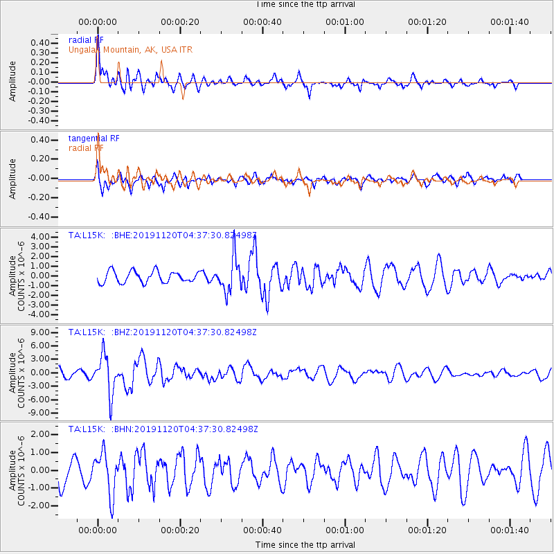
L15K Ungalak Mountain, AK, USA - Earthquake Result Viewer
*The percent match for this event was below the threshold and hence no stack was calculated.
| Earthquake location: |
Off Coast Of Chiapas, Mexico |
| Earthquake latitude/longitude: |
14.0/-93.1 |
| Earthquake time(UTC): |
2019/11/20 (324) 04:27:07 GMT |
| Earthquake Depth: |
26 km |
| Earthquake Magnitude: |
6.3 Mww |
| Earthquake Catalog/Contributor: |
NEIC PDE/us |
|
| Network: |
TA USArray Transportable Network (new EarthScope stations) |
| Station: |
L15K Ungalak Mountain, AK, USA |
| Lat/Lon: |
61.68 N/161.49 W |
| Elevation: |
219 m |
|
| Distance: |
67.6 deg |
| Az: |
331.348 deg |
| Baz: |
102.538 deg |
| Ray Param: |
$rayparam |
*The percent match for this event was below the threshold and hence was not used in the summary stack. |
|
| Radial Match: |
64.861496 % |
| Radial Bump: |
393 |
| Transverse Match: |
59.945484 % |
| Transverse Bump: |
373 |
| SOD ConfigId: |
19951751 |
| Insert Time: |
2019-12-04 04:49:41.192 +0000 |
| GWidth: |
2.5 |
| Max Bumps: |
400 |
| Tol: |
0.001 |
|
Signal To Noise
| Channel | StoN | STA | LTA |
| TA:L15K: :BHZ:20191120T04:37:30.82498Z | 6.410224 | 4.4460144E-6 | 6.9358174E-7 |
| TA:L15K: :BHN:20191120T04:37:30.82498Z | 1.8318799 | 1.2208632E-6 | 6.6645373E-7 |
| TA:L15K: :BHE:20191120T04:37:30.82498Z | 3.1026998 | 1.823339E-6 | 5.876621E-7 |
| Arrivals |
| Ps | |
| PpPs | |
| PsPs/PpSs | |


