You are here: Home > Network List > TA - USArray Transportable Network (new EarthScope stations) Stations List
> Station K13A Stover Farm, Hazelton, ID, USA > Earthquake Result Viewer
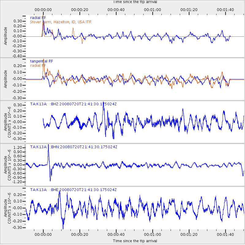
K13A Stover Farm, Hazelton, ID, USA - Earthquake Result Viewer
*The percent match for this event was below the threshold and hence no stack was calculated.
| Earthquake location: |
Bonin Islands, Japan Region |
| Earthquake latitude/longitude: |
27.8/139.6 |
| Earthquake time(UTC): |
2008/07/20 (202) 21:30:29 GMT |
| Earthquake Depth: |
481 km |
| Earthquake Magnitude: |
5.8 MW, 5.1 MB, 5.8 MW |
| Earthquake Catalog/Contributor: |
WHDF/NEIC |
|
| Network: |
TA USArray Transportable Network (new EarthScope stations) |
| Station: |
K13A Stover Farm, Hazelton, ID, USA |
| Lat/Lon: |
42.65 N/114.08 W |
| Elevation: |
1222 m |
|
| Distance: |
82.6 deg |
| Az: |
45.571 deg |
| Baz: |
300.943 deg |
| Ray Param: |
$rayparam |
*The percent match for this event was below the threshold and hence was not used in the summary stack. |
|
| Radial Match: |
67.76533 % |
| Radial Bump: |
384 |
| Transverse Match: |
45.347237 % |
| Transverse Bump: |
315 |
| SOD ConfigId: |
2504 |
| Insert Time: |
2010-03-07 06:02:31.908 +0000 |
| GWidth: |
2.5 |
| Max Bumps: |
400 |
| Tol: |
0.001 |
|
Signal To Noise
| Channel | StoN | STA | LTA |
| TA:K13A: :BHN:20080720T21:41:30.175024Z | 5.745755 | 4.956955E-7 | 8.62716E-8 |
| TA:K13A: :BHE:20080720T21:41:30.175024Z | 0.57054406 | 4.3404047E-8 | 7.607484E-8 |
| TA:K13A: :BHZ:20080720T21:41:30.175024Z | 2.1372335 | 1.4844493E-7 | 6.9456576E-8 |
| Arrivals |
| Ps | |
| PpPs | |
| PsPs/PpSs | |


