You are here: Home > Network List > US - United States National Seismic Network Stations List
> Station HAWA Hanford, Washington, USA > Earthquake Result Viewer
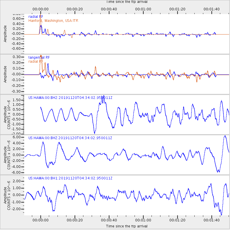
HAWA Hanford, Washington, USA - Earthquake Result Viewer
*The percent match for this event was below the threshold and hence no stack was calculated.
| Earthquake location: |
Off Coast Of Chiapas, Mexico |
| Earthquake latitude/longitude: |
14.0/-93.1 |
| Earthquake time(UTC): |
2019/11/20 (324) 04:27:07 GMT |
| Earthquake Depth: |
26 km |
| Earthquake Magnitude: |
6.3 Mww |
| Earthquake Catalog/Contributor: |
NEIC PDE/us |
|
| Network: |
US United States National Seismic Network |
| Station: |
HAWA Hanford, Washington, USA |
| Lat/Lon: |
46.39 N/119.53 W |
| Elevation: |
364 m |
|
| Distance: |
39.2 deg |
| Az: |
330.877 deg |
| Baz: |
136.947 deg |
| Ray Param: |
$rayparam |
*The percent match for this event was below the threshold and hence was not used in the summary stack. |
|
| Radial Match: |
79.652054 % |
| Radial Bump: |
330 |
| Transverse Match: |
63.30346 % |
| Transverse Bump: |
400 |
| SOD ConfigId: |
19951751 |
| Insert Time: |
2019-12-04 04:50:29.873 +0000 |
| GWidth: |
2.5 |
| Max Bumps: |
400 |
| Tol: |
0.001 |
|
Signal To Noise
| Channel | StoN | STA | LTA |
| US:HAWA:00:BHZ:20191120T04:34:02.950011Z | 5.553141 | 2.9008738E-6 | 5.223843E-7 |
| US:HAWA:00:BH1:20191120T04:34:02.950011Z | 2.319985 | 6.4145183E-7 | 2.7648966E-7 |
| US:HAWA:00:BH2:20191120T04:34:02.950011Z | 2.3375738 | 1.0081822E-6 | 4.3129427E-7 |
| Arrivals |
| Ps | |
| PpPs | |
| PsPs/PpSs | |


